
Single Publication
Could not determine your location.
 Wildfire
 Prescribed Fire
 Burned Area
Response
Burned Area
Response Other
Other
Smoke from Devil’s Thumb Fire Likely Until Monsoons Arrive
Devil's Thumb Fire
Publication Type: News 07/26/2023
GRANBY, Colo. (July 14, 2023) – While firefighters have successfully contained portions of the Devil’s Thumb Fire, residents in Grand County, Boulder County, Gilpin County and surrounding areas may continue to experience the presence of smoke throughout the summer and fall until natural moisture controls the fire.
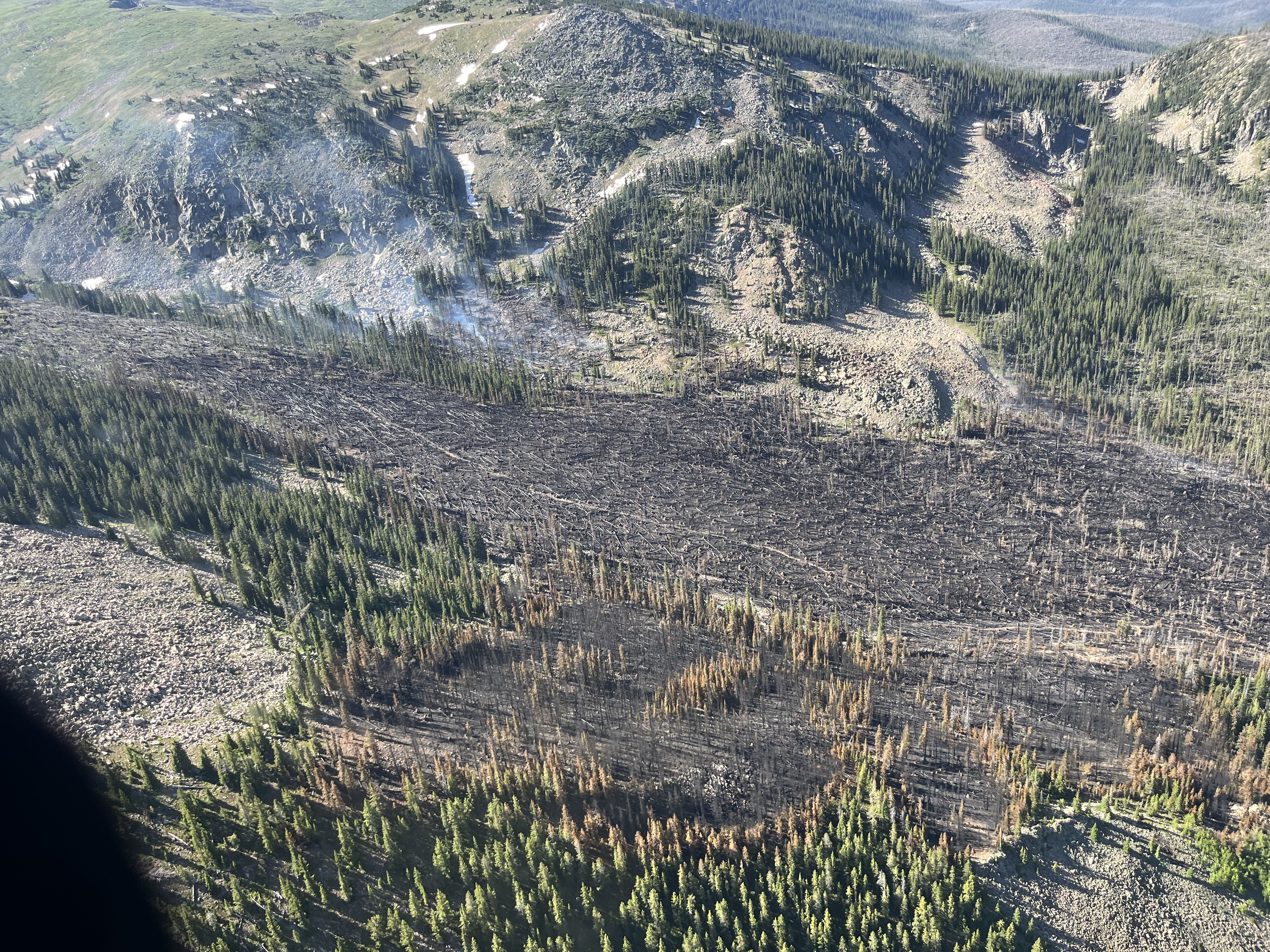
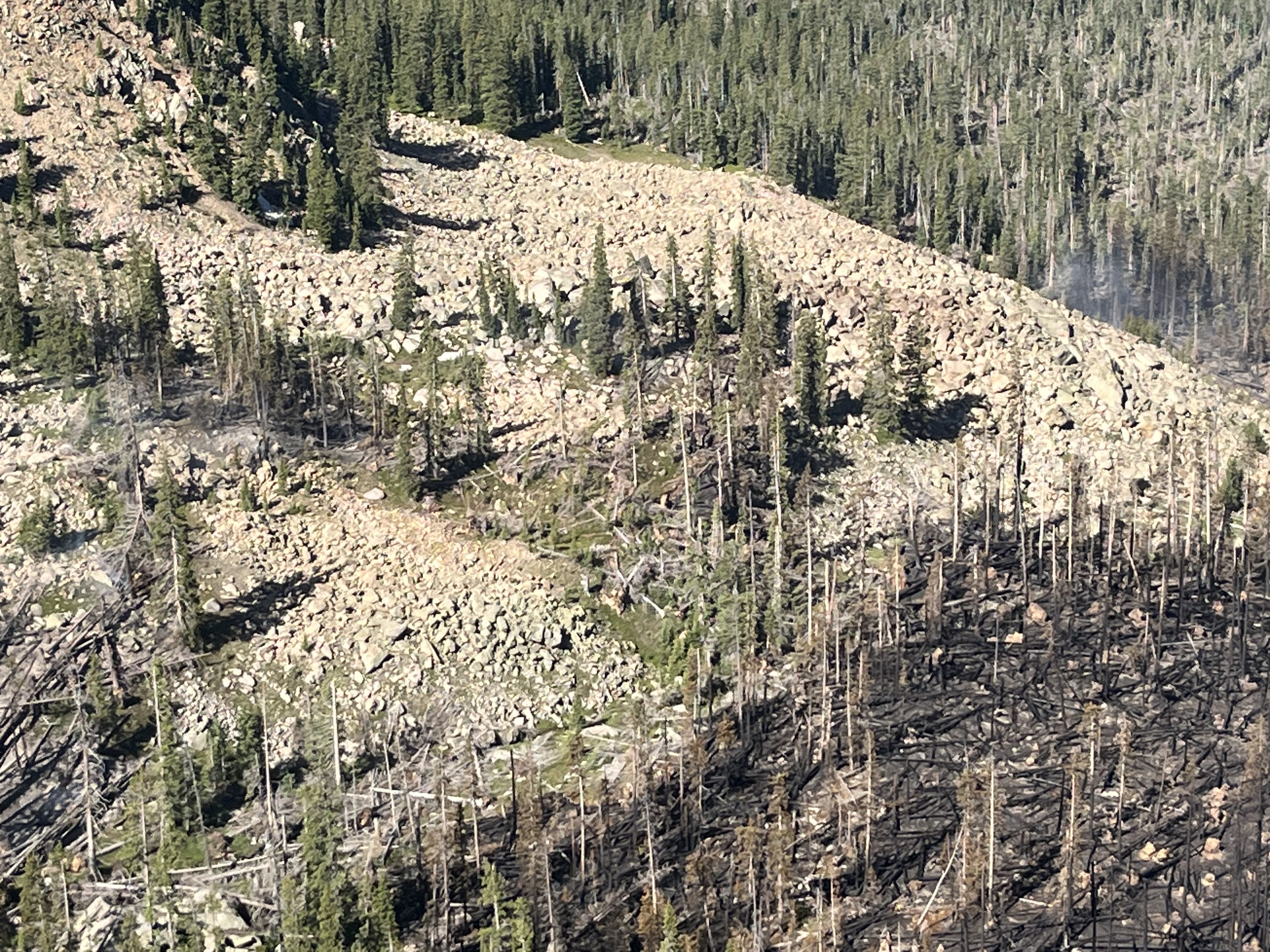
Steep slopes, rugged terrain, and unstable conditions are posing significant challenges to firefighting operations. Located in Wilderness with steep, inoperable terrain, the fire area is full of standing dead and leaning or snagged trees, posing an extremely hazardous situation for firefighters. Additionally, fallen trees are stacked as high as 20 feet in places, making portions of the fire inaccessible. The incident’s leadership is carefully considering these factors in determining how firefighters will engage in suppression efforts.
Ensuring the safety of firefighters and the public is the top priority for the Incident Management Team.
The thick “jackstraw” of vegetation in the fire area is expected to retain heat and continue to burn slowly over time. The region is expected to experience continued hot and dry weather over the coming weeks, which may contribute to occasional active fire behavior and visible smoke. The Incident Management Team is closely monitoring weather conditions and fire behavior and is adjusting strategies accordingly.
Aircraft and specialized equipment have been authorized to aid suppression efforts when there is a potential threat to life and property, but this support will not be able to put the fire out.
Due to the fire’s location just west of the Continental Divide, smoke is expected to drift into Boulder Valley under certain weather conditions, potentially impacting towns from Nederland to the City of Boulder. The visible presence or smell of smoke does not necessarily indicate an immediate threat to life or property. There may still be pockets of burning vegetation within the perimeter, and these hot spots can smolder for extended periods, emitting smoke as the heavy timber slowly burns. Fire crews are continuing to scout and extinguish hot spots when and where it is safe to do so.
The safety and well-being of the community and firefighters remains the top priority. Whenever there is active wildfire in the area, residents and visitors are encouraged to remain informed, prepared, and vigilant. Forest leadership and the Incident Management Team appreciate the patience, cooperation, and support of residents and visitors during this continuing incident.
The Devil’s Thumb Fire started on July 4, 2023, due to a lightning strike in the Indian Peaks Wilderness Area on the Arapaho National Forest, 7 miles northeast of Fraser. It is currently 79-acres, a reduction in size from previous reports due to better mapping and is approximately 25-percent contained. Follow us on Facebook and Twitter. To receive email updates, join our email list and select Forest Health & Fire: Grand County (Winter Park, Fraser, Granby, Grand Lake, Hot Sulphur).