
Single Publication
Could not determine your location.
 Wildfire
 Prescribed Fire
 Burned Area
Response
Burned Area
Response Other
Other
Daily Update - 07/08/23
Devil's Thumb Fire
Publication Type: News 07/11/2023
Yesterday, fire crews secured more perimeter line on the fire, increasing containment to 30%. Fire size remains at 95 acres. A weather station was installed in the fire area to help improve weather data collection and forecasting for the fire area. A radio repeater was placed in the same area to improve communications with crews during operations.
Today, continued smoldering of dead and down fuels is expected, with limited growth over the next operational period. While working on securing the fire perimeter the firefighters reached a point of very steep and hazardous terrain. With firefighter safety in mind, today’s operations will include completing handline already in place and monitoring efforts. There is one Type II crew, two Hotshot crews, one engine, one ambulance, and two helicopters working the fire at this time.
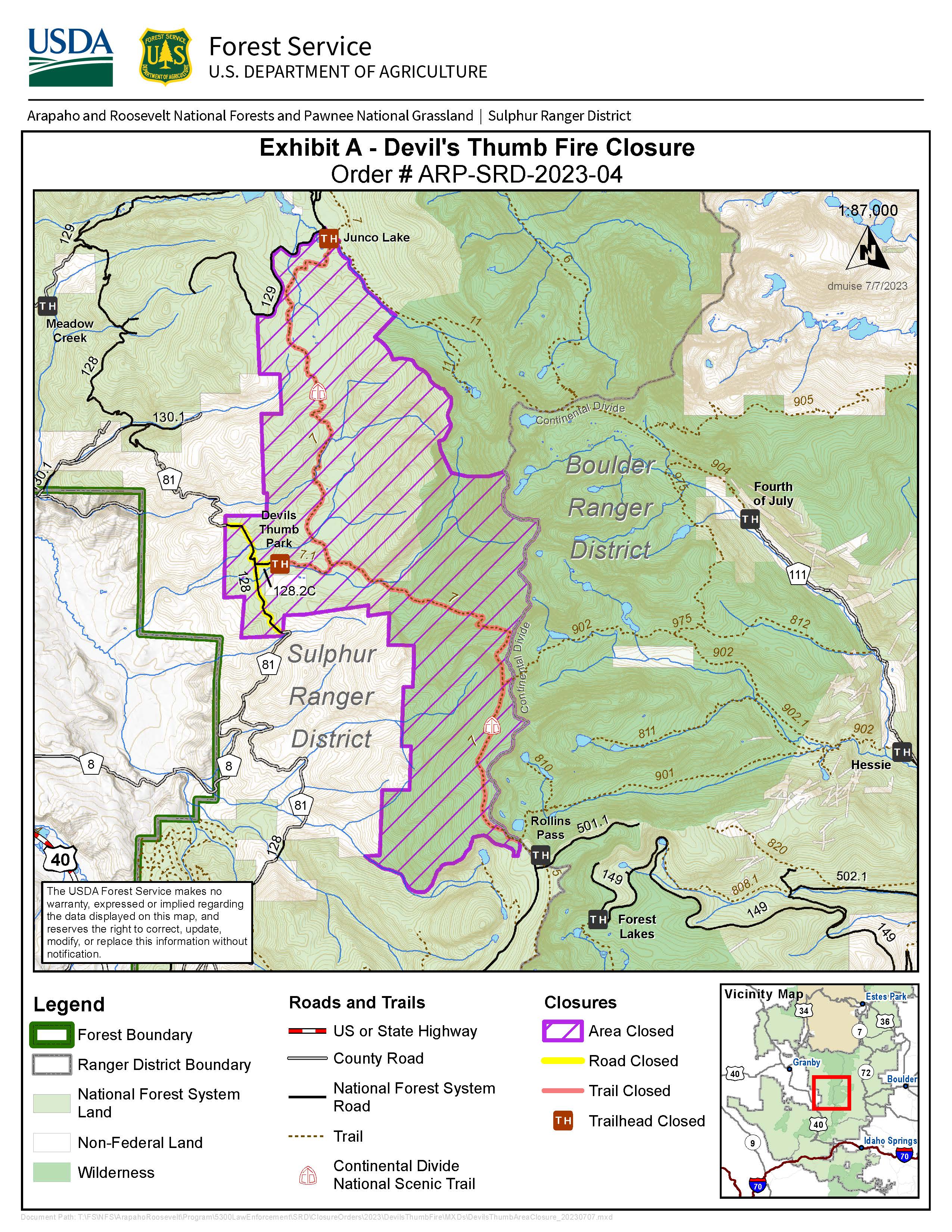
A closure order went into effect yesterday that includes portions of the Water Board Road (128) and the Continental Divide Trail.
The road closure follows the James Peak Protection Area boundary along the Water Board Road (128) on NFS land near Devil’s Thumb Park Trailhead off County Road 81, and Devil’s Thumb Trailhead Road (128.2).
Key trailheads and landmarks in the closure area include:
- The High Lonesome Trail, including a section of the Continental Divide Trail, from Junco Lake Trailhead to the intersection of the King Lake Trail.
- Devil’s Thumb Park Trail and Trailhead
- The last ¼ mile of the Devil’s Thumb Trail to the east of the intersection with the High Lonesome Trail
This closure is in place for public and firefighter safety during operations for the Devil’s Thumb Fire, and to support firefighting efforts. There are currently no evacuations in place.