
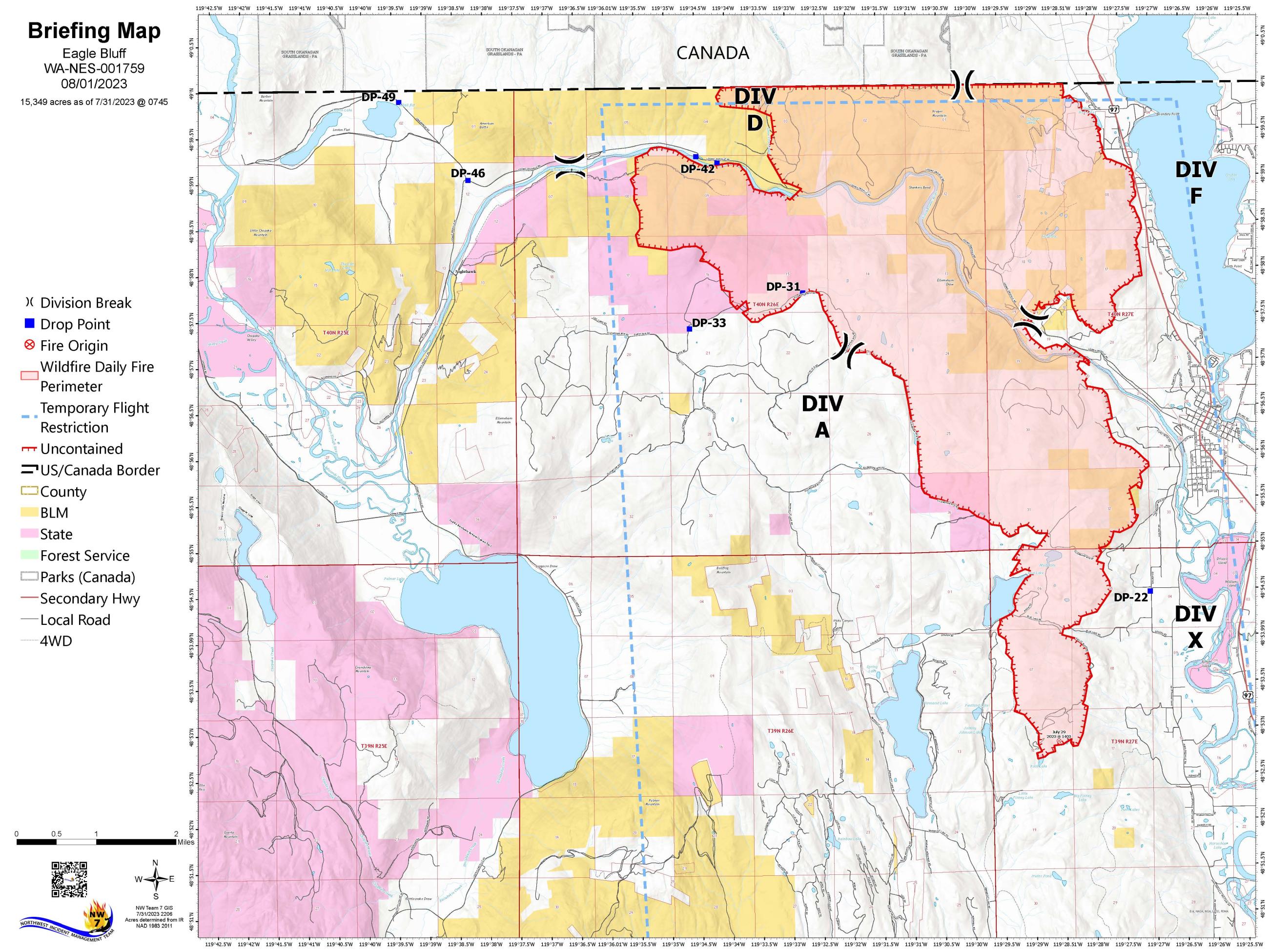
The fire is burning just west of Oroville, Wash. on lands managed by the Washington Department of Natural Resources and the Spokane District – Bureau of Land Management and has crossed into Canada. The cause of the fire is still under investigation by the Washington Department of Natural Resources. The Team’s top priority is public and firefighter safety, and they are using a full suppression strategy to contain the fire as small as possible, as safely as possible.
Northwest Incident Management Team 7 is currently managing the fire. Ongoing coordination with the British Columbia Wildfire Service will seek to tie in firefighting efforts on both sides of the border.
For up-to-date information on wildfire closures and evacuations, follow Okanogan County Emergency Management at https://okanogancounty.org/government/emergency_management/
| Current as of | Wed, 08/16/2023 - 18:33 |
|---|---|
| Incident Type | Wildfire |
| Cause | Currently under investigation |
| Date of Origin | |
| Location | Approximately 3/4 mile to the West of the town of Oroville, North to the Canadian Border near the town of Osoyoos |
| Incident Commander | Northwest Incident Management Team 7 (Type 2). Incident Commander Nate LeFevre |
| Incident Description | The Eagle Bluff Fire is exhibiting moderate fire behavior including short runs, flanking, torching and short-range spotting. |
| Coordinates |
48° 53' 20'' Latitude
-119° 28' 10
'' Longitude
|
| Total Personnel: | 447 |
|---|---|
| Size | 16,428 Acres |
| Percent of Perimeter Contained | 80% |
| Fuels Involved | Short Grass (1 foot), Brush (2 feet), Timber (Litter and Understory) |
| Significant Events | For the most current information regarding evacuations: https://okanogancounty.org/government/emergency_management/active_incidents.php |
| Planned Actions |
Secure containment lines, mop-up and IR around structures, identify repair needs, as well as work on identified suppression repair needs. |
|---|---|
| Projected Incident Activity |
Smoldering and smoke production will continue until around sunset then decrease to minimal activity overnight. Forecast includes showers overnight with possibly of wetting rain. No perimeter growth expected overnight. |
| Weather Concerns | A weak cold front will track across the fire Monday morning increasing the threat for showers and embedded thunderstorms. There is a 30-40 percent chance for rainfall amounts greater than a tenth of an inch. Morning showers and storms will give way to partial afternoon clearing, cooler temperatures, and higher humidity values. Sunbreaks in the afternoon will bring a 20 percent ha nee for redeveloping showers and thunderstorms prior to unset but this activity will be more localized and carry lower confidence. Winds on Monday will be light, starting from the east and southeast in the morning then switching to the west in the afternoon. |
|---|