
Given forecasted weather showing an increase in moisture and a decrease in temperatures, we will pause burning operations, until a more favorable weather window presents itself. Once operations have resumed, updates will be made available.
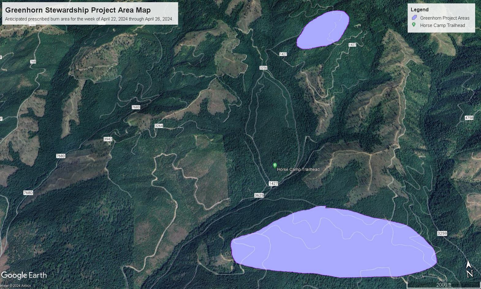
This project is located half a mile south of Horse Camp Trailhead and three miles east of Highway 6.
The objective of burning this slash is to remove fuel accumulations and create areas for planting new trees.
| Current as of | Tue, 04/30/2024 - 11:19 |
|---|---|
| Incident Type | Prescribed Fire |
| Date of Origin | |
| Location | This project is located half a mile south of Horse Camp Trailhead and three miles east of Highway 6 |
| Incident Commander | Palouse Ranger District Fire and Fuels Staff |
| Coordinates |
46° 58' 55.27'' Latitude
-116° 36' 6.20
'' Longitude
|
| Size | 170 Acres |
|---|
| Planned Actions |
Patrol and monitor prescribed burn units. Everything has been burning exceptionally well, with very ideal spring burning conditions. |
|---|
| Weather Concerns | Weather forecasts predict more precipitation to come throughout the weekend, as well as a decrease in temperatures. With the decrease in temperatures, increase in humidity values, and increase in precipitation potential, opportunities for prescribed fire to make a beneficial impact will become less likely. Because of this, burning operations on the Nez Perce-Clearwater National Forests will pause until weather conditions become more favorable. |
|---|