U.S. flag

An official website of the United States government

Here's how you know

Incident Media Maps

Zoom to your location
Reset map zoom and position

Could not determine your location.

Quartz Ridge Fire

Unit Information

15 Burnett Court 
Durango, 
81301 
15 Burnett Court 
Durango, 
81301 

Incident Contacts

  • Fire Information
    Email:
    2023.quartzridge@firenet.gov
    Phone:
    970–426–5370
    Hours:
    8 am - 5 pm

Maps Gallery

Image options: [ Full Size ] - [ PDF ]

Quartz Ridge Fire remains at 2850 acres as of mapping on 9/21/23

Image options: [ Full Size ] - [ PDF ]

Map showing the perimeter of the Quartz Ridge Fire. The fire is 2,850 acres in size.

Image options: [ Full Size ] -

Image options: [ Full Size ] - [ PDF ]

Image options: [ Full Size ] - [ PDF ]

Updated Quartz Ridge Fire map, now scaled to include more landmarks on the Rio Grande National Forest.

Image options: [ Full Size ] -

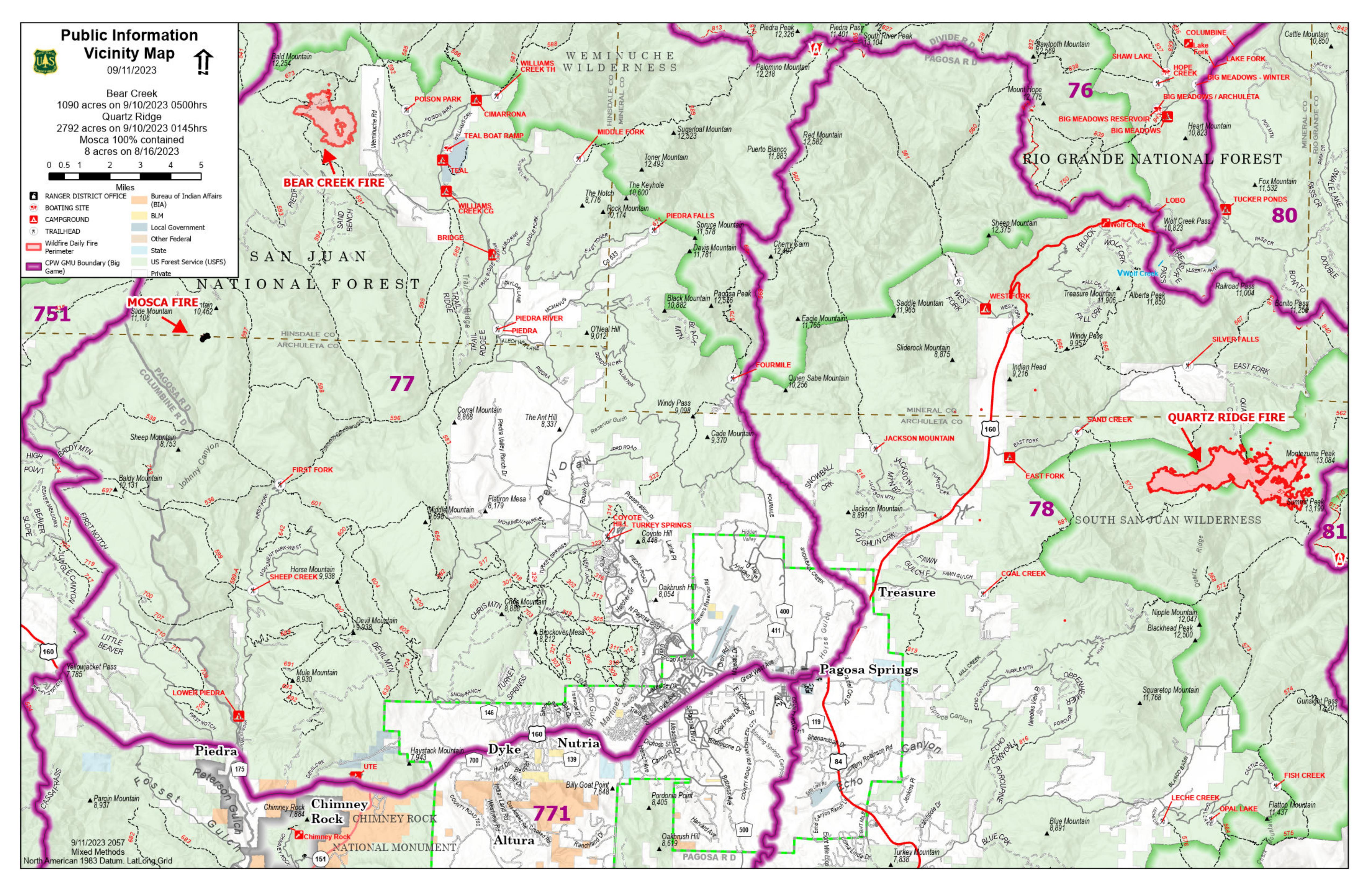
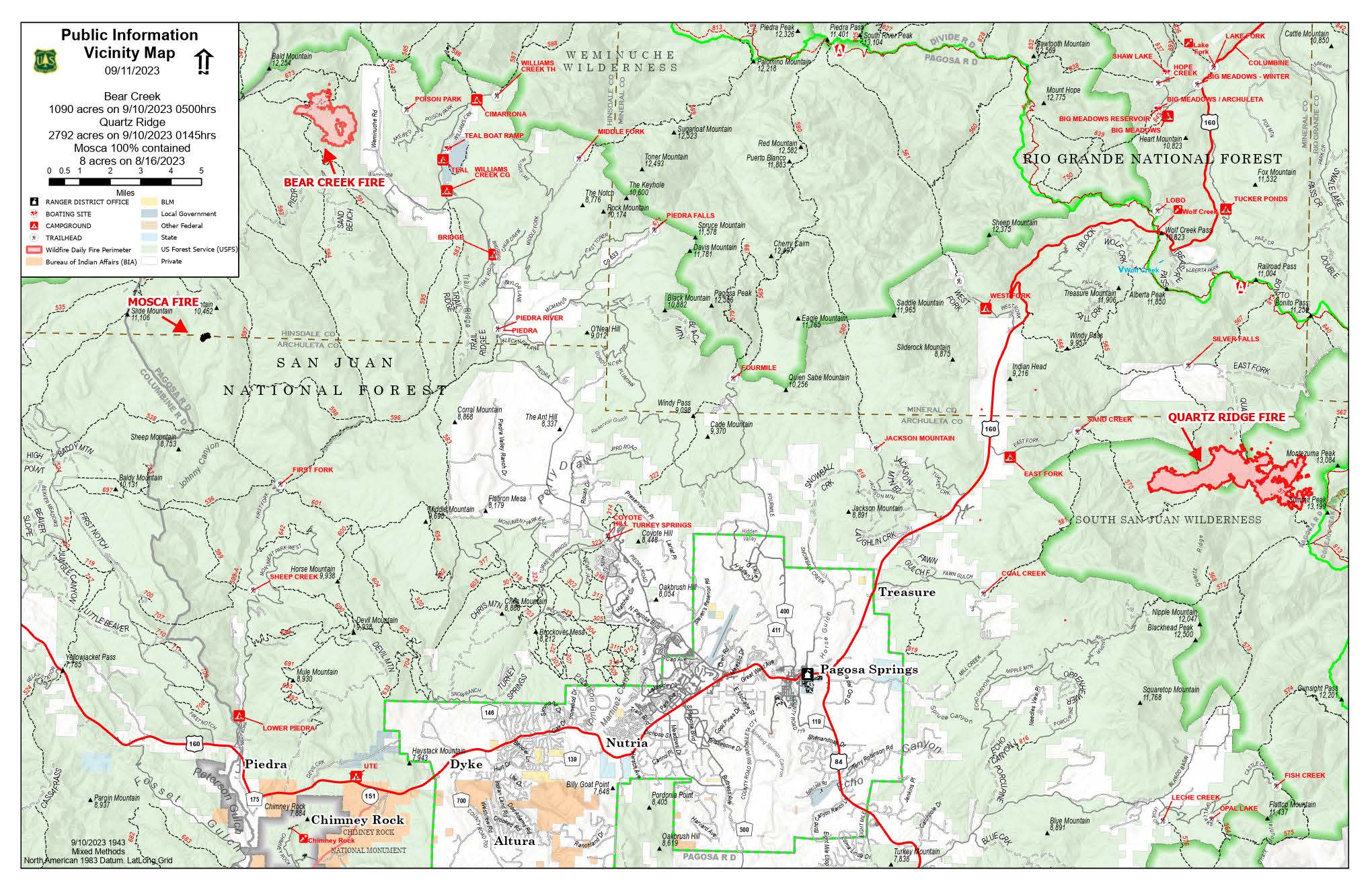
Vicinity maps for Quartz Ridge and Bear Creek fires, with Hunting/Game Management Units (GMU)

Image options: [ Full Size ] - [ PDF ]

Image options: [ Full Size ] -

Public Information Vicinity Map - Quartz Ridge / Bear Creek Fires

Image options: [ Full Size ] -

Quartz Ridge Fire - Daily Map - 9/11

Image options: [ Full Size ] -

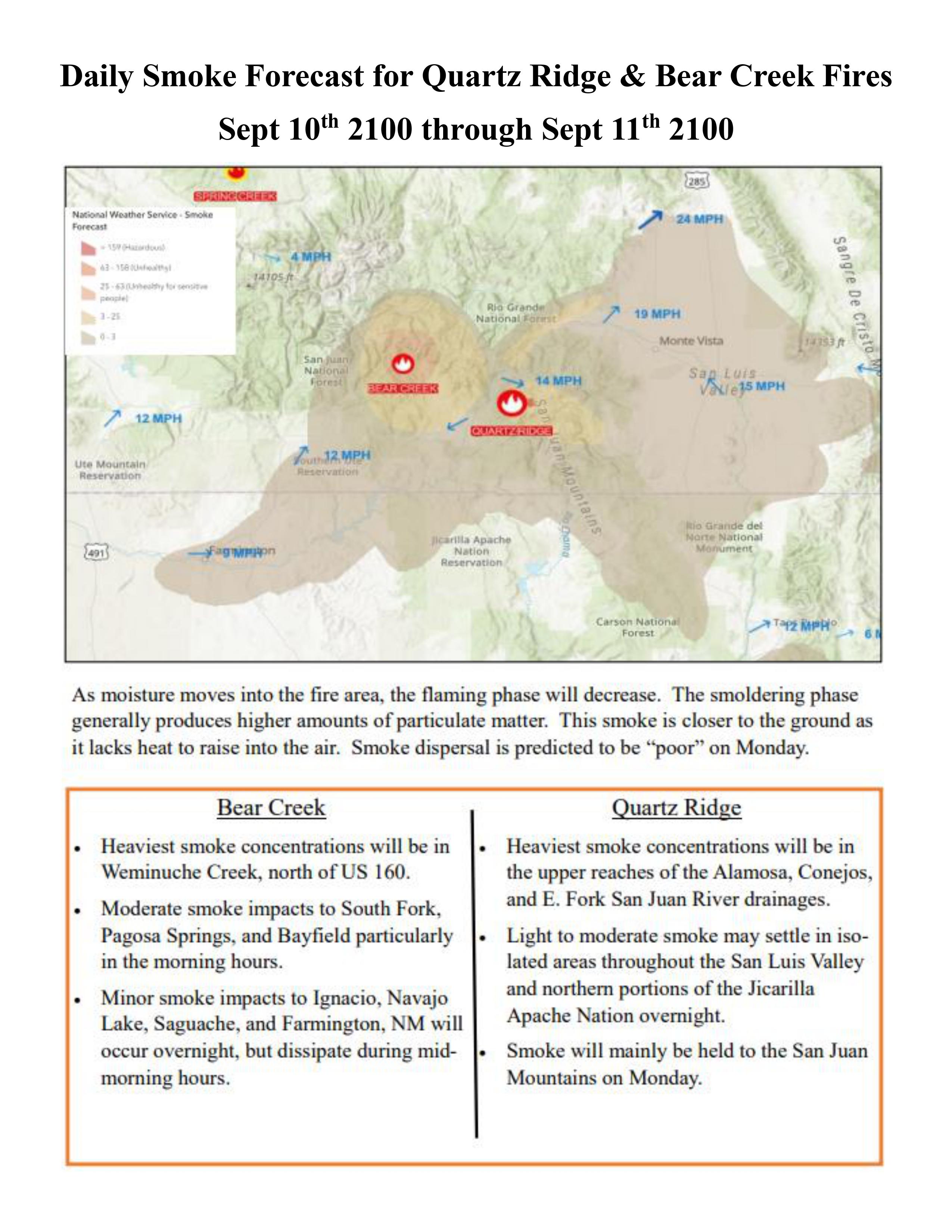
As moisture moves into the fire area, the flaming phase will decrease.  The smoldering phase generally produces higher amounts of particulate matter. This smoke is closer to the ground as it lacks heat to raise into the air.  Smoke dispersal is predicted to be "poor" on Monday. 
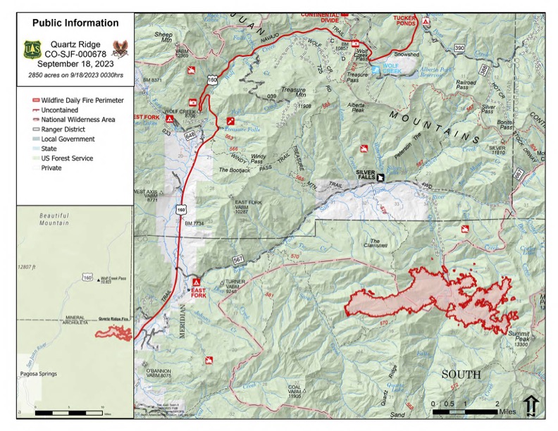
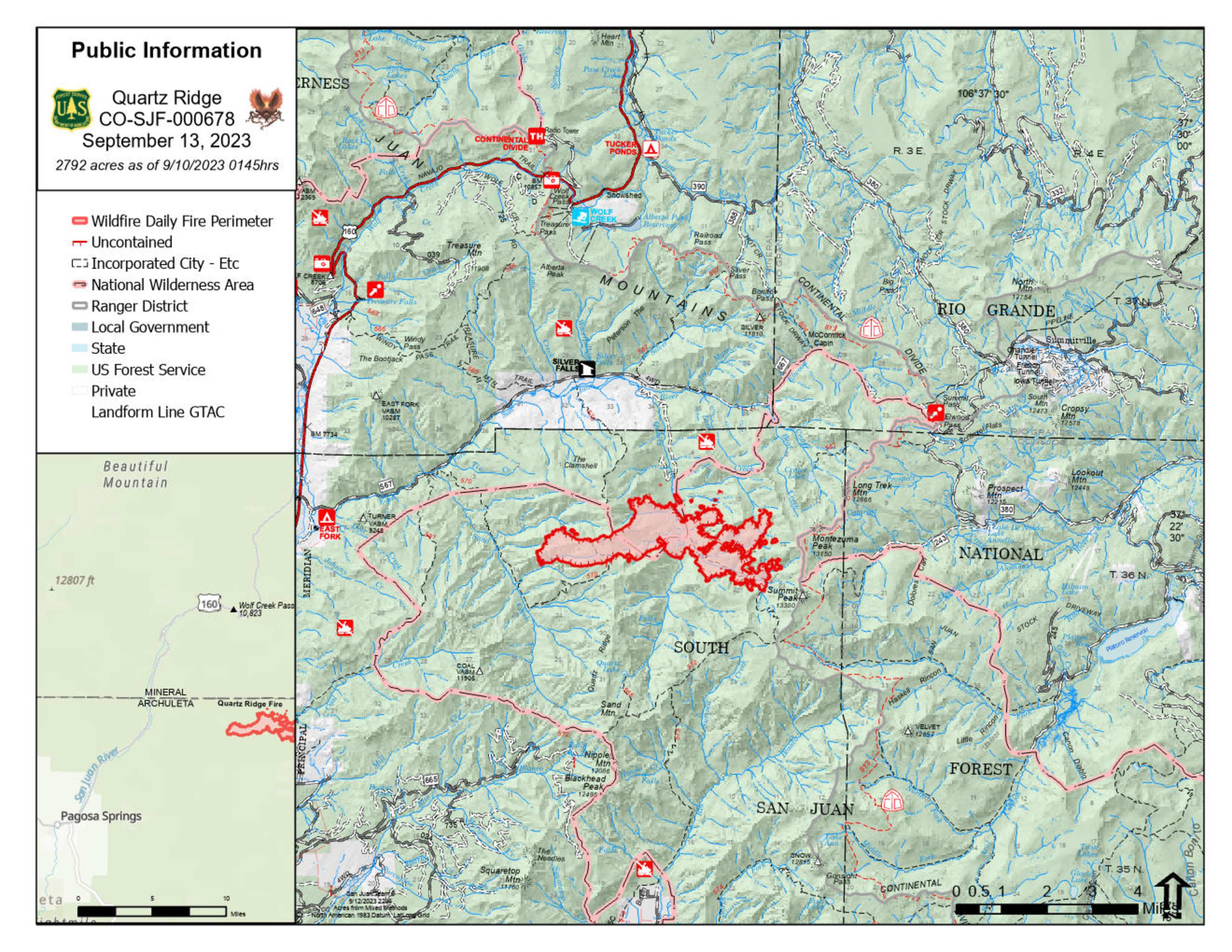
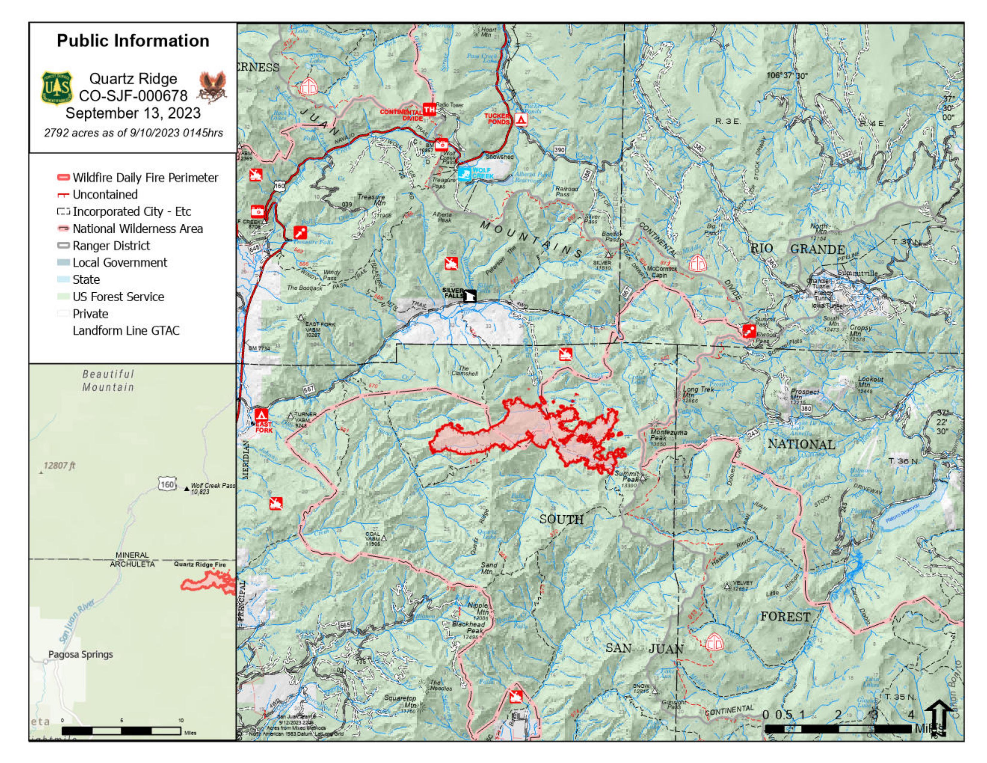
QUARTZ RIDGE:

The heaviest smoke concentrations will be in the upper reaches of the Alamosa, Conejos, and East Fork of the San Juan River drainages.

Light to moderate smoke may settle in isolated areas throughout the San Luis Valley and northern portions of the Jicarilla Apache Nation overnight.

Smoke will mainly be held to the San Juan Mountains on Monday.

Image options: [ Full Size ] - [ PDF ]