U.S. flag

An official website of the United States government

Here's how you know

Incident Media Maps

Zoom to your location
Reset map zoom and position

Could not determine your location.

Smith River Complex

Unit Information

1330 Bayshore Way 
Eureka, 
95501 
1330 Bayshore Way 
Eureka, 
95501 

Incident Contacts

  • Email:
    2023.smithrivercomplex@firenet.gov
    Phone:
    South: 707-383-9727 North: 541-801-3495
    Hours:
    8 a.m. - 8 p.m.

Maps Gallery

Image options: [ Full Size ] - [ PDF ]

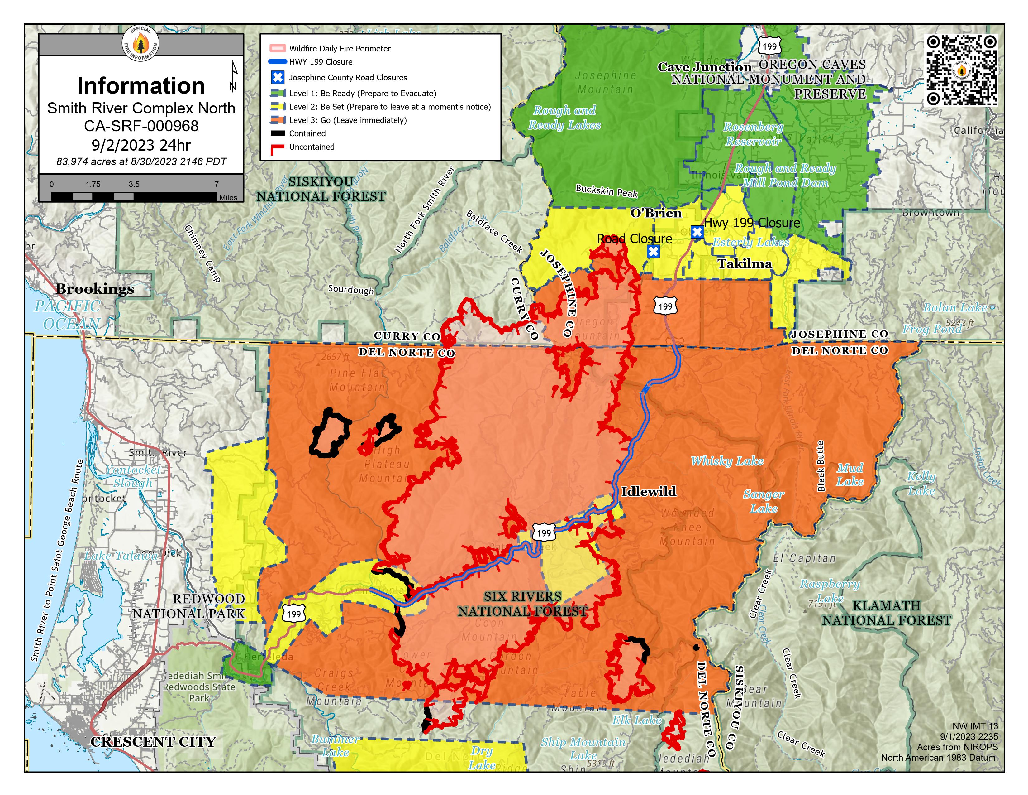
Smith River Complex North PIO Map 9/2/2023 with evacuations and Hwy 199 closure. Solid black lines on the fire edges indicate containment.


NOTE: Del Norte County Sheriff's Office has changed some evacuations. For the latest evacuation levels please check the Fire First Response Map found at https://www.rvem.org/

or visit the Del Norte County Office of Emergency Services Facebook page at https://www.facebook.com/DelNorteOfficeOfEmergencyServices/.
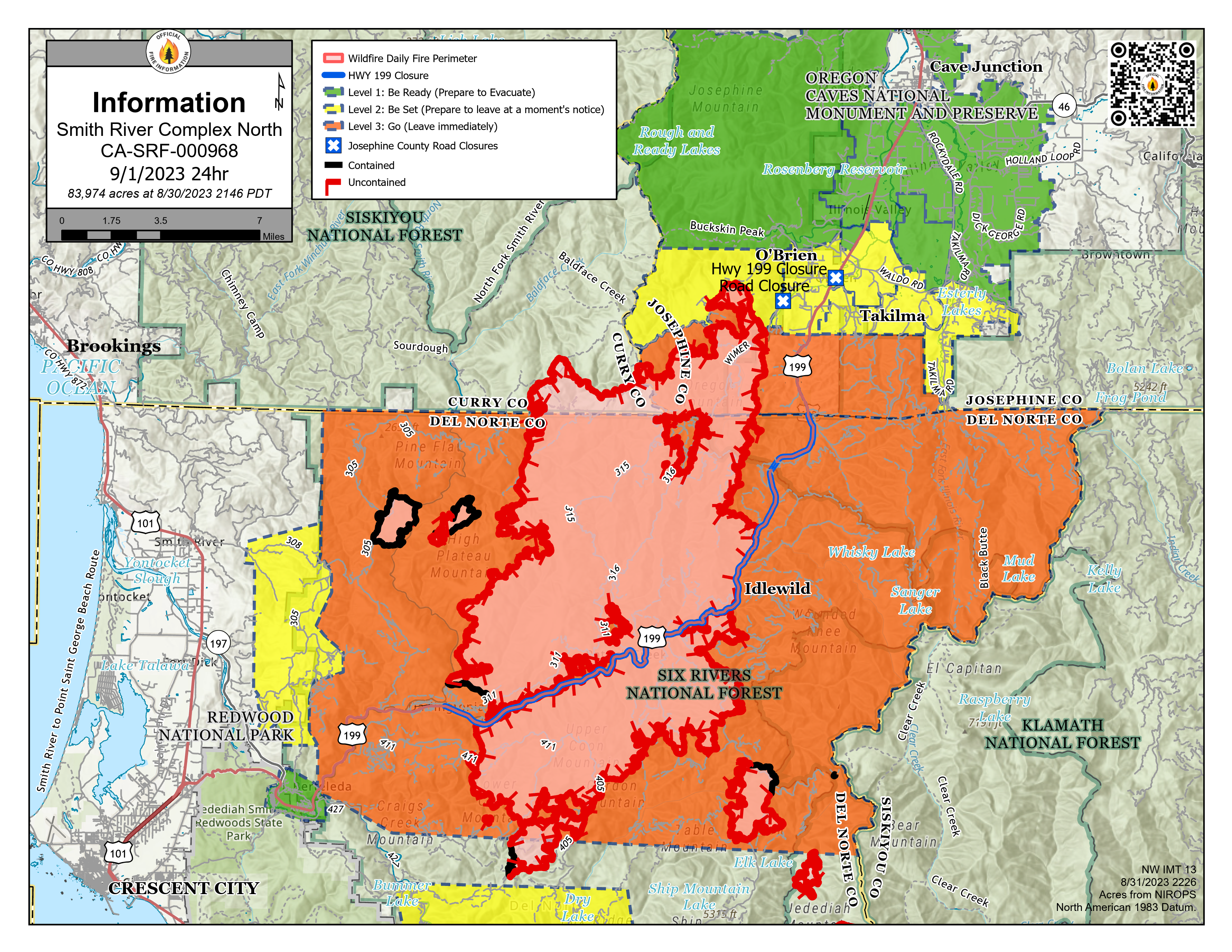
Image options: [ Full Size ] - [ PDF ]

Smith River Complex North PIO Map 9/1/2023 with evacuations and Hwy 199 closure. Solid black lines on the fire edges indicate containment.

NOTE: Del Norte County Sheriff's Office has changed some evacuations from Level 3 - GO NOW to Level 2 - Get Set. For the latest evacuation levels please check the Fire First Response Map found at https://www.rvem.org/ or visit the Del Norte County Office of Emergency Services Facebook page at https://www.facebook.com/DelNorteOfficeOfEmergencyServices/.

Image options: [ Full Size ] - [ PDF ]

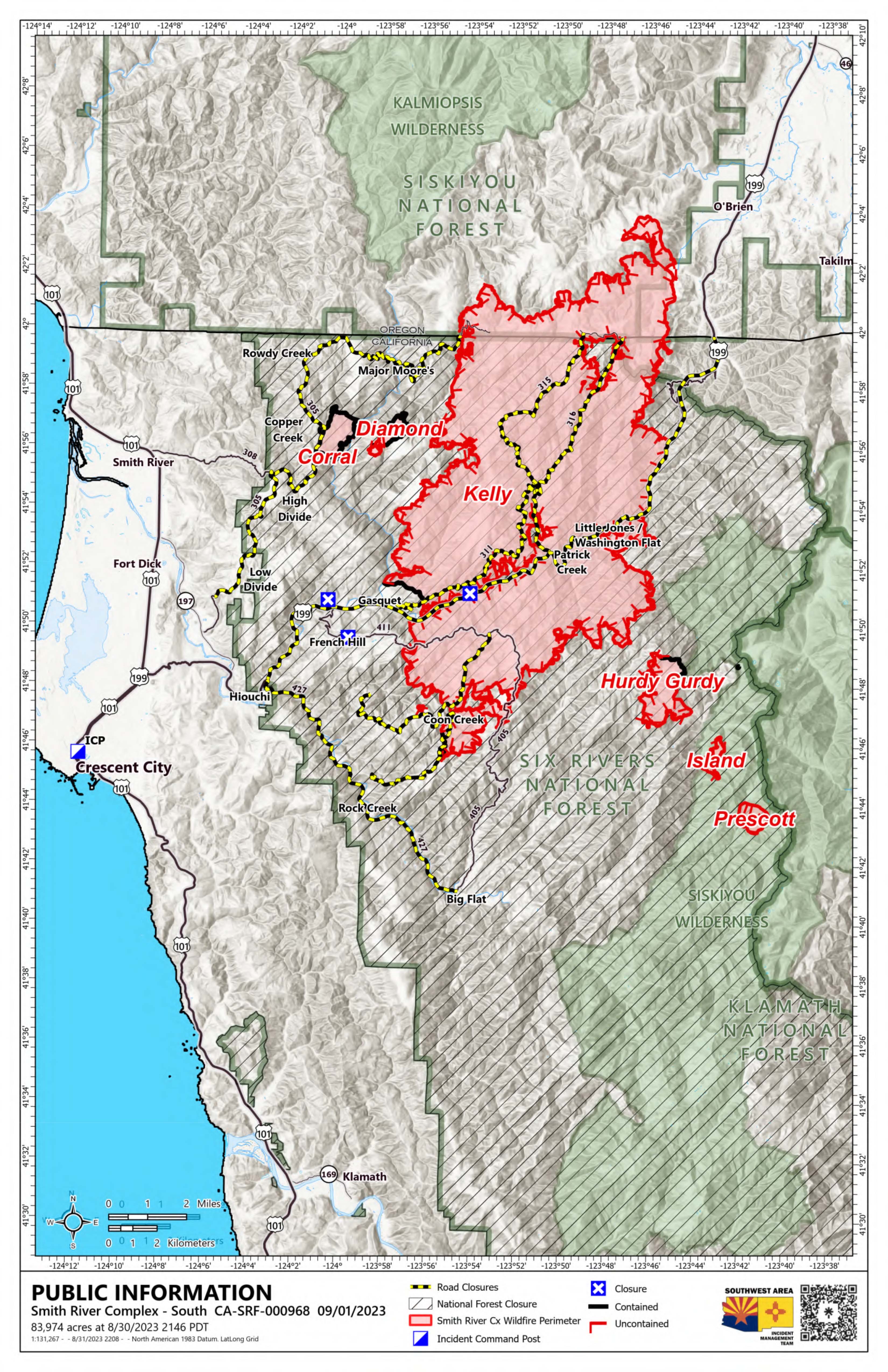
Smith River Complex South Update PIO Map 9/01/2023

Image options: [ Full Size ] - [ PDF ]

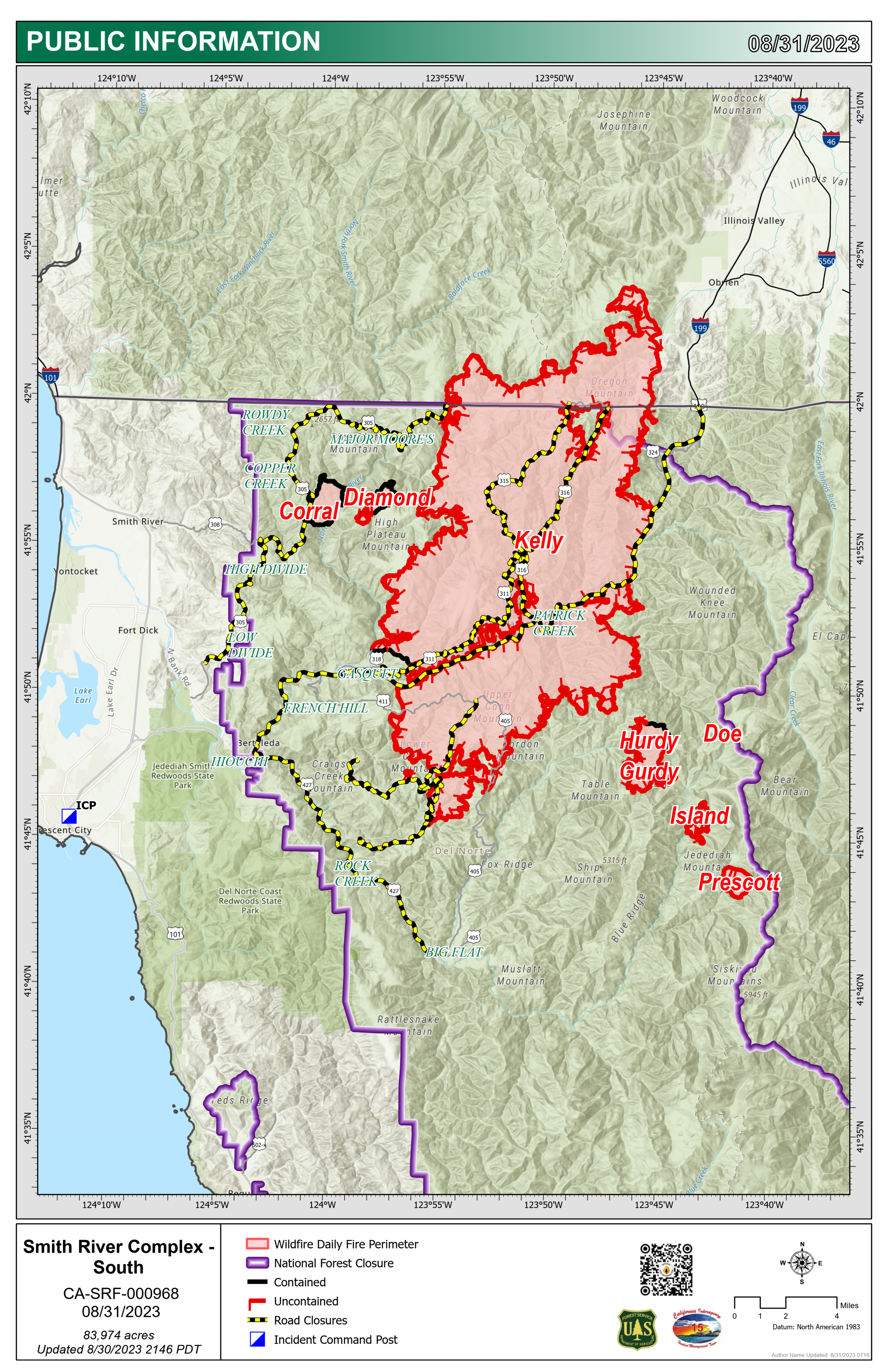
Smith River Complex South Update PIO Map 8/31/2023

Image options: [ Full Size ] - [ PDF ]

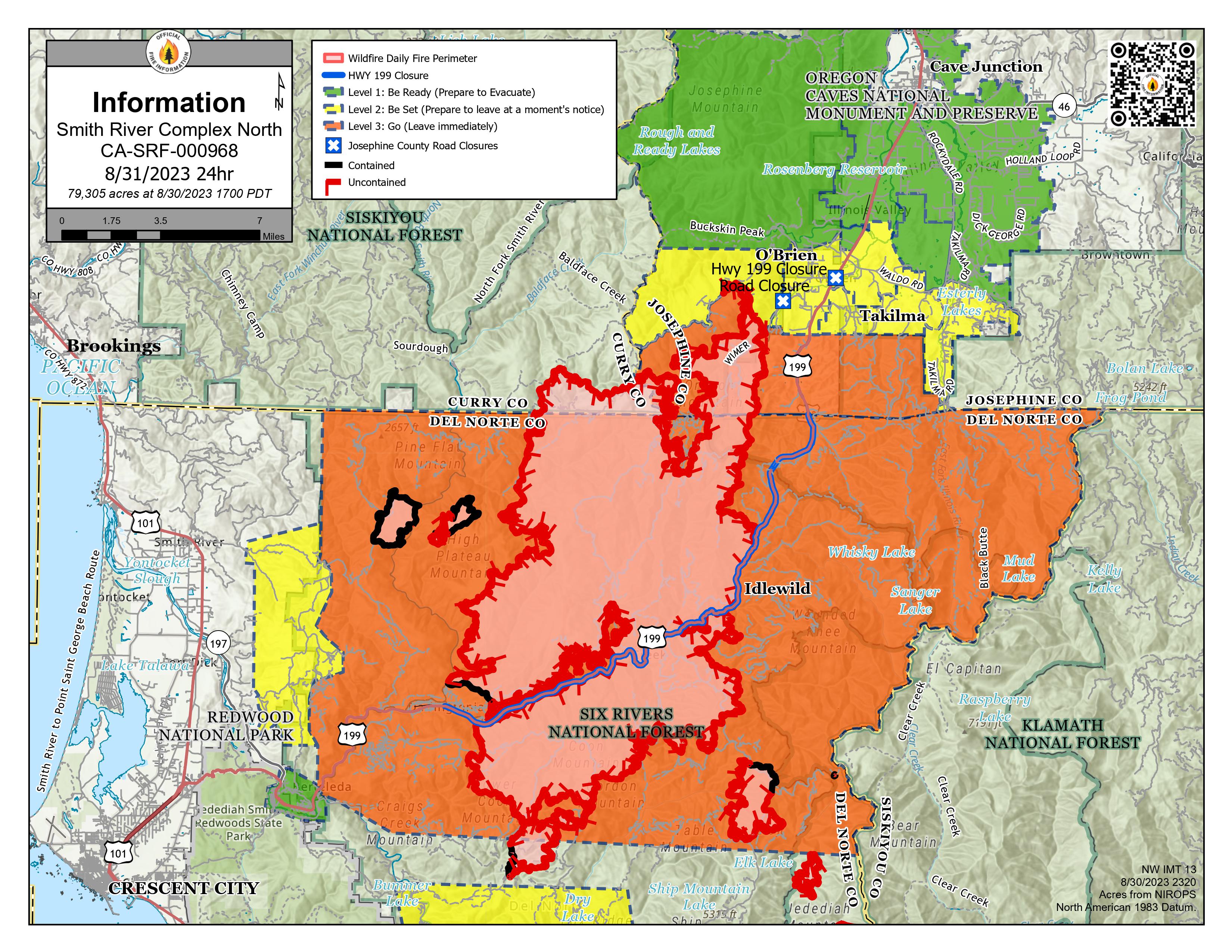
Smith River Complex North PIO Map 8/31/2023 with evacuations and Hwy 199 closure. Solid black lines on the fire edges indicate containment.

Image options: [ Full Size ] - [ PDF ]

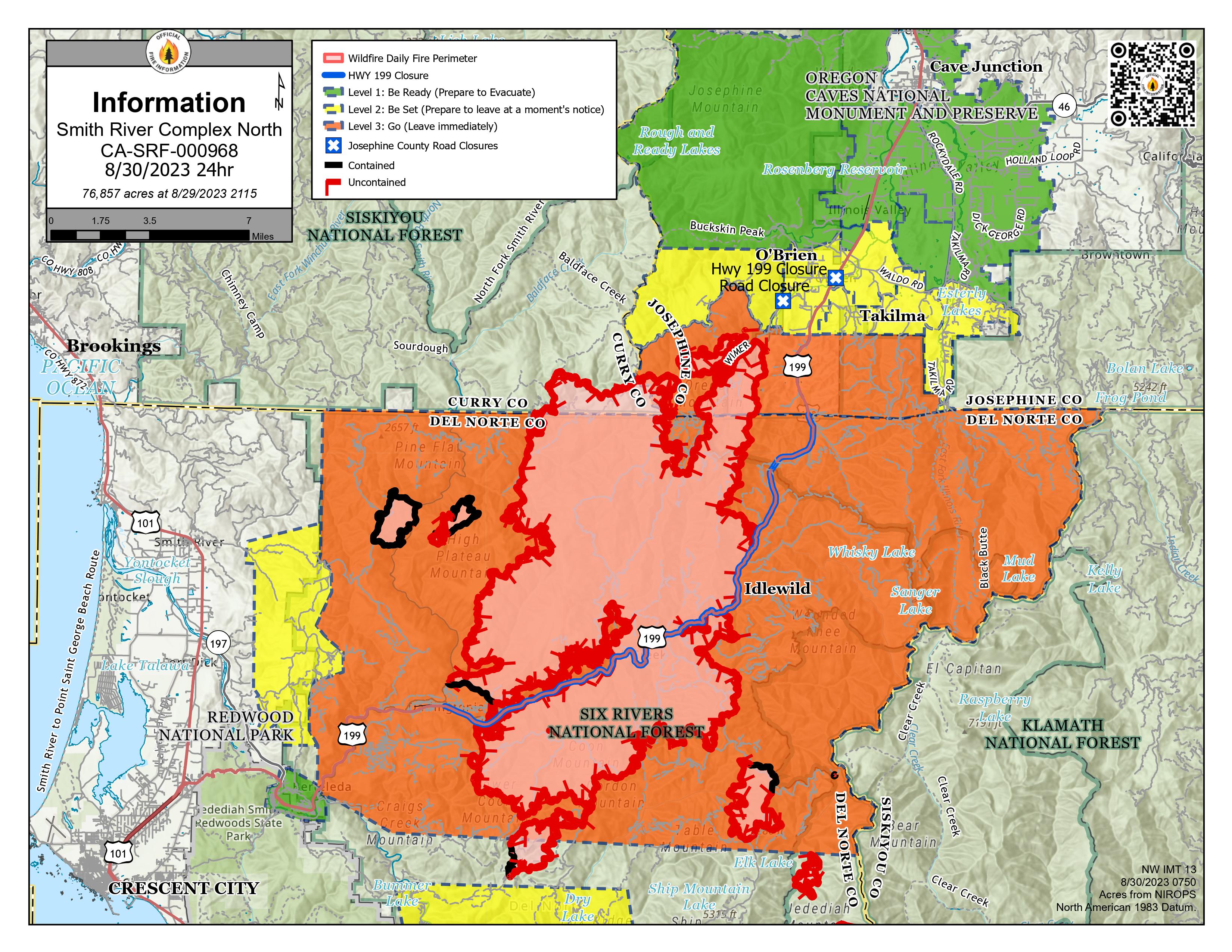
Smith River Complex North PIO Map 8/30/2023 with evacuations and Hwy 199 closure. Solid black lines on the fire edges indicate containment.

Image options: [ Full Size ] -

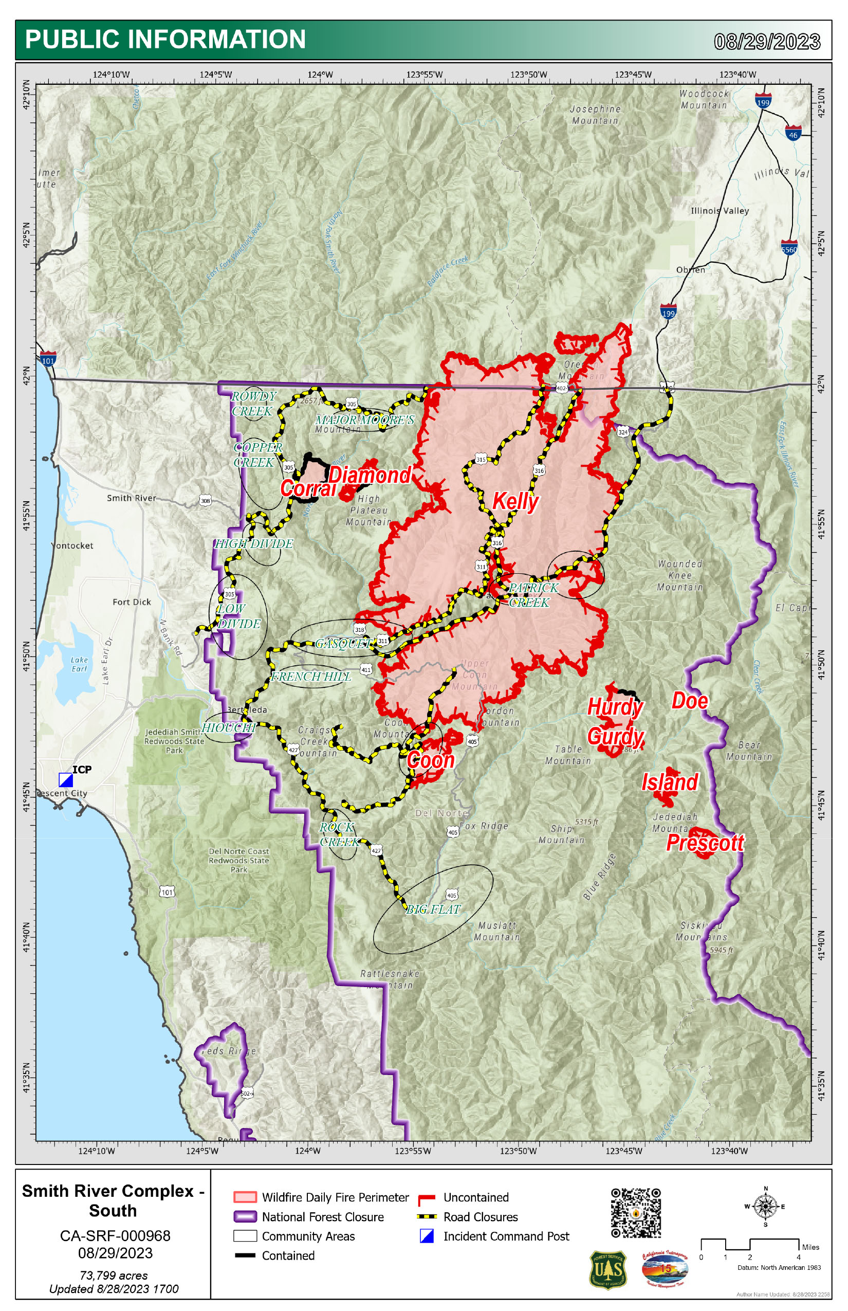
Smith River Complex South Update PIO Map 8.29.2023

Image options: [ Full Size ] - [ PDF ]

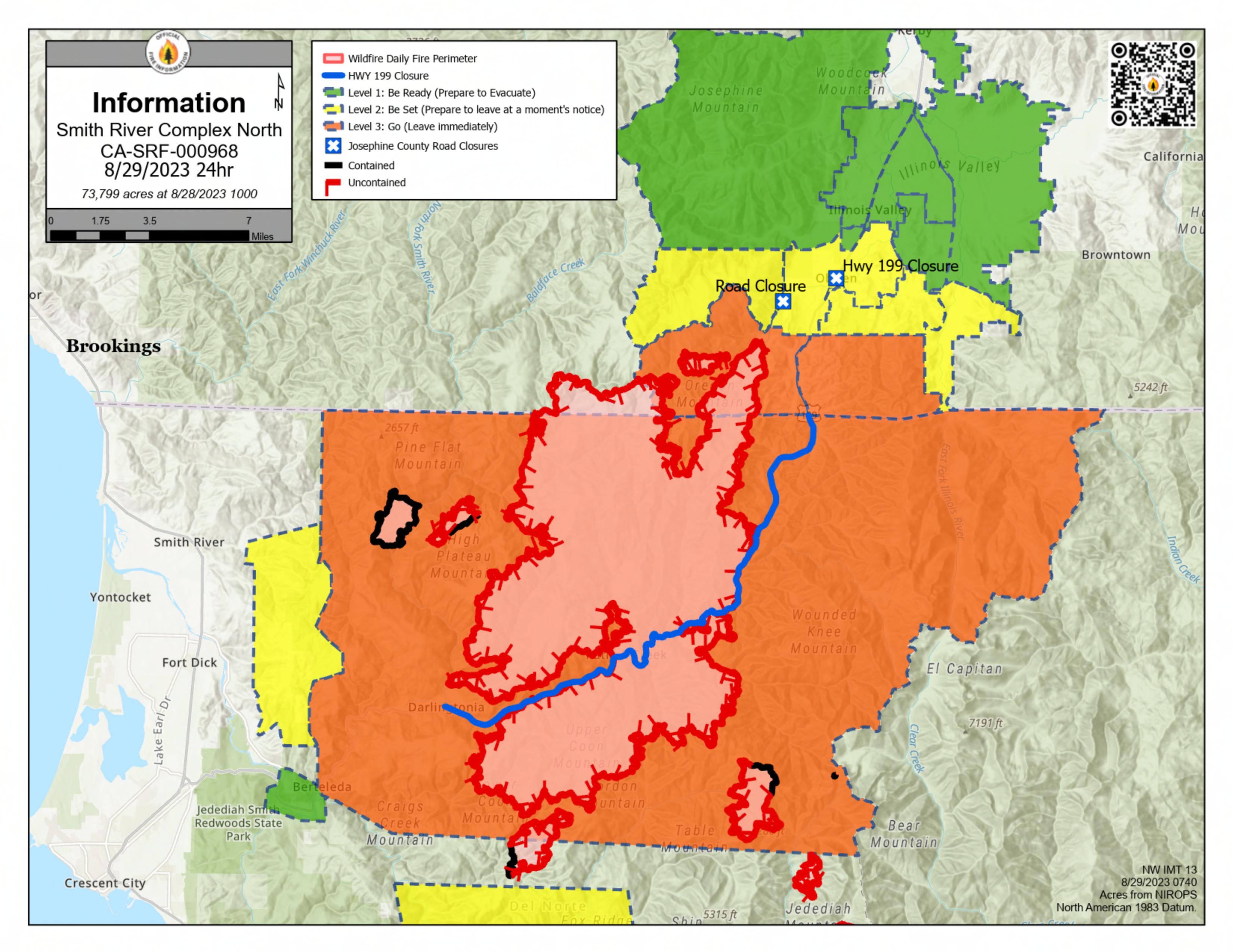
Smith River Complex North PIO Map 8/29/2023 with evacuations and Hwy 199 closure. Solid black lines on the fire edges indicate containment.

Image options: [ Full Size ] - [ PDF ]

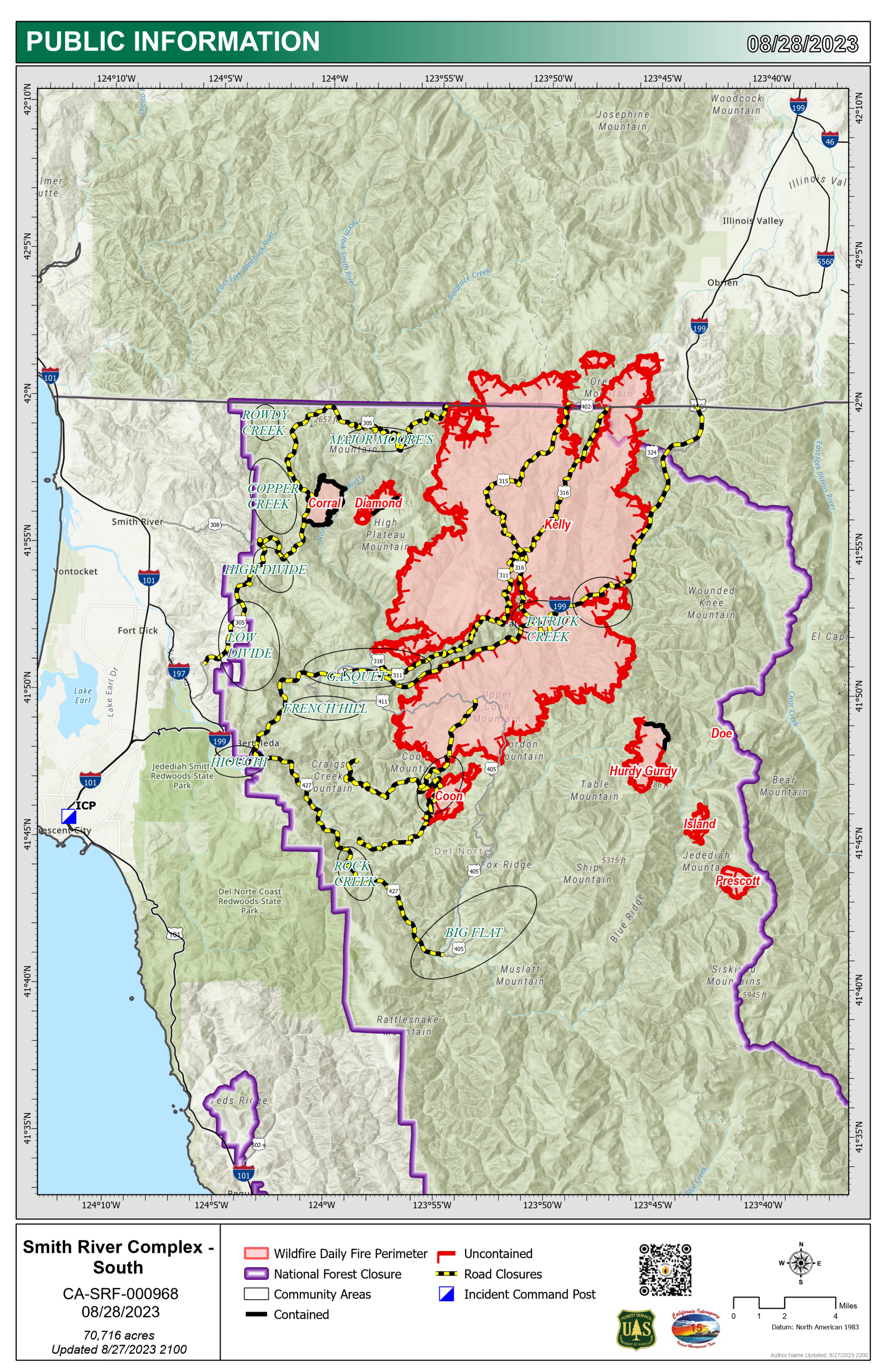
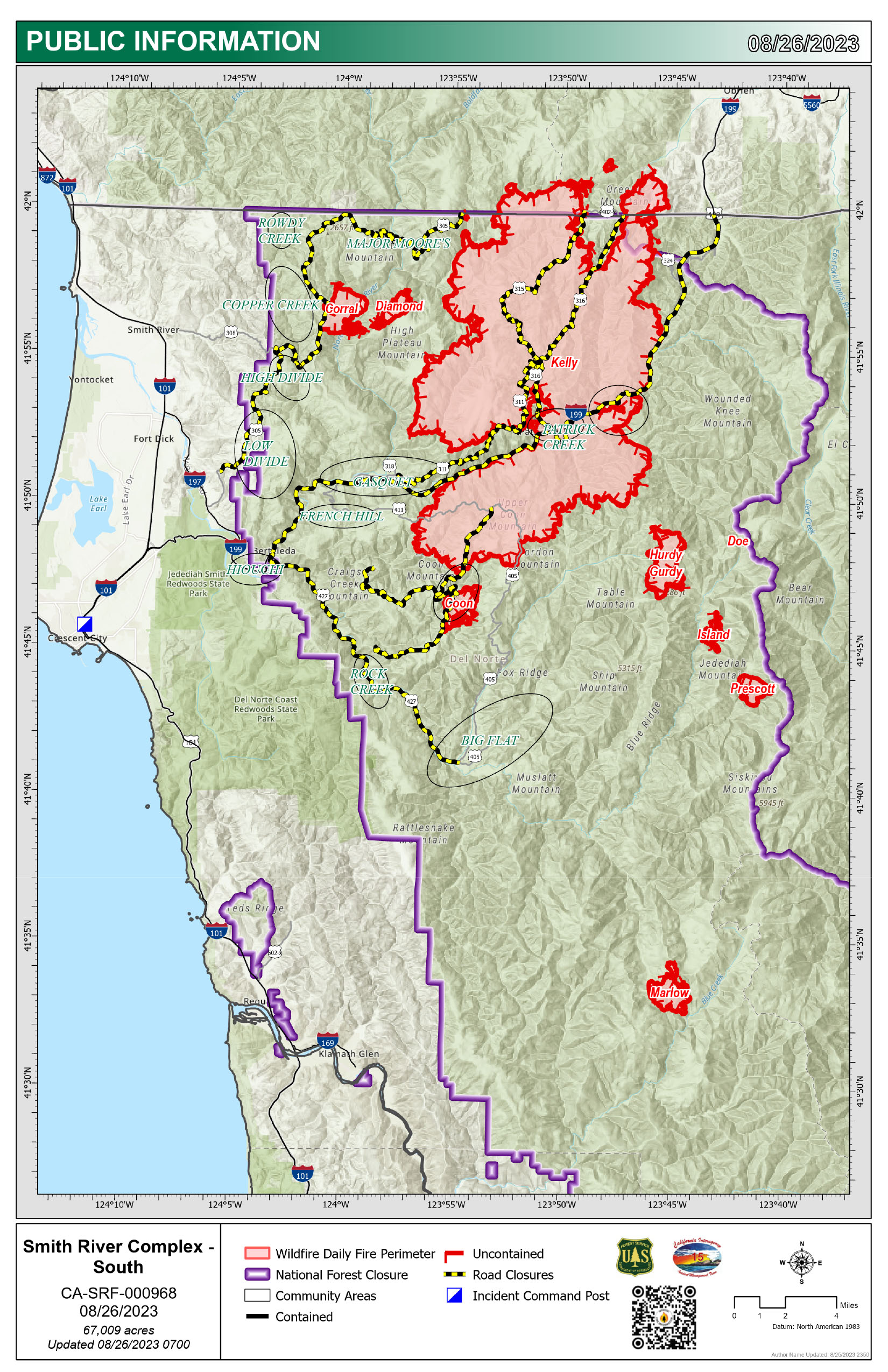
Smith River Complex South PIO Map 8/28/2023 showing community areas

Image options: [ Full Size ] - [ PDF ]

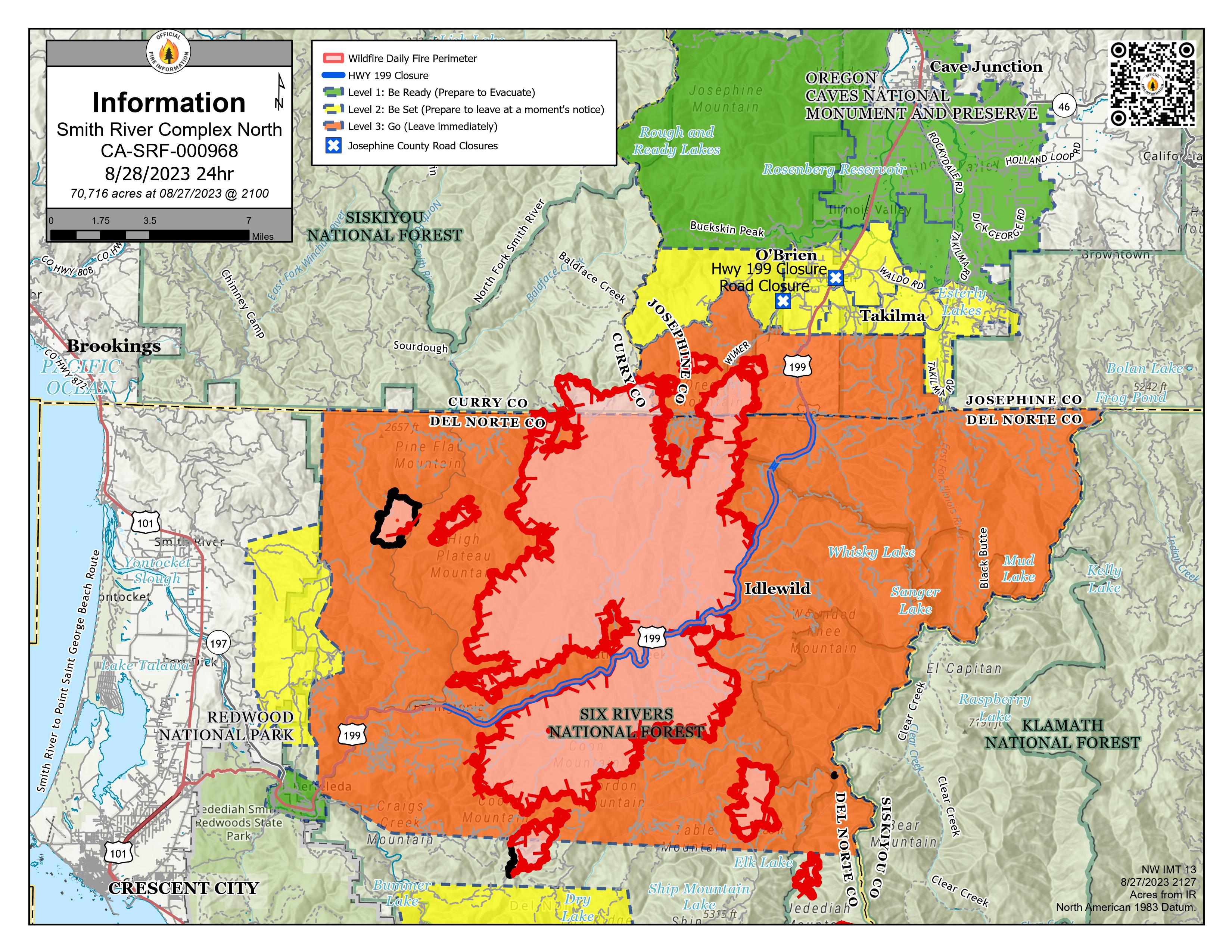
Smith River Complex North PIO Map 8/28/2023 with evacuations

Image options: [ Full Size ] - [ PDF ]

Smith River Complex South PIO Map

Image options: [ Full Size ] -

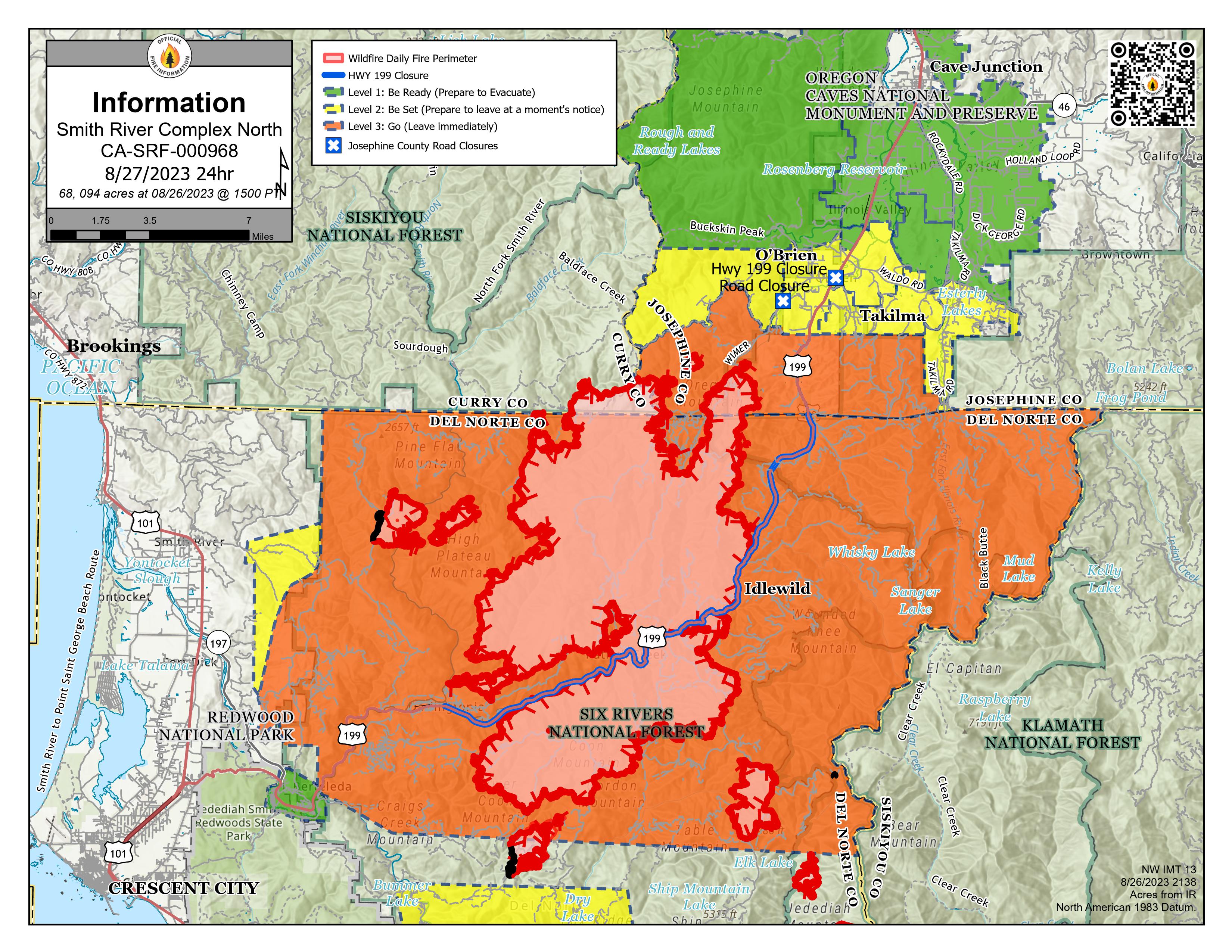
Smith River Complex North PIO Map 8/27/2023 with evacuations