
The fire has received significant moisture, there is minimal fire activity, and this will be the last update for the season unless there's an unforeseen change in conditions.
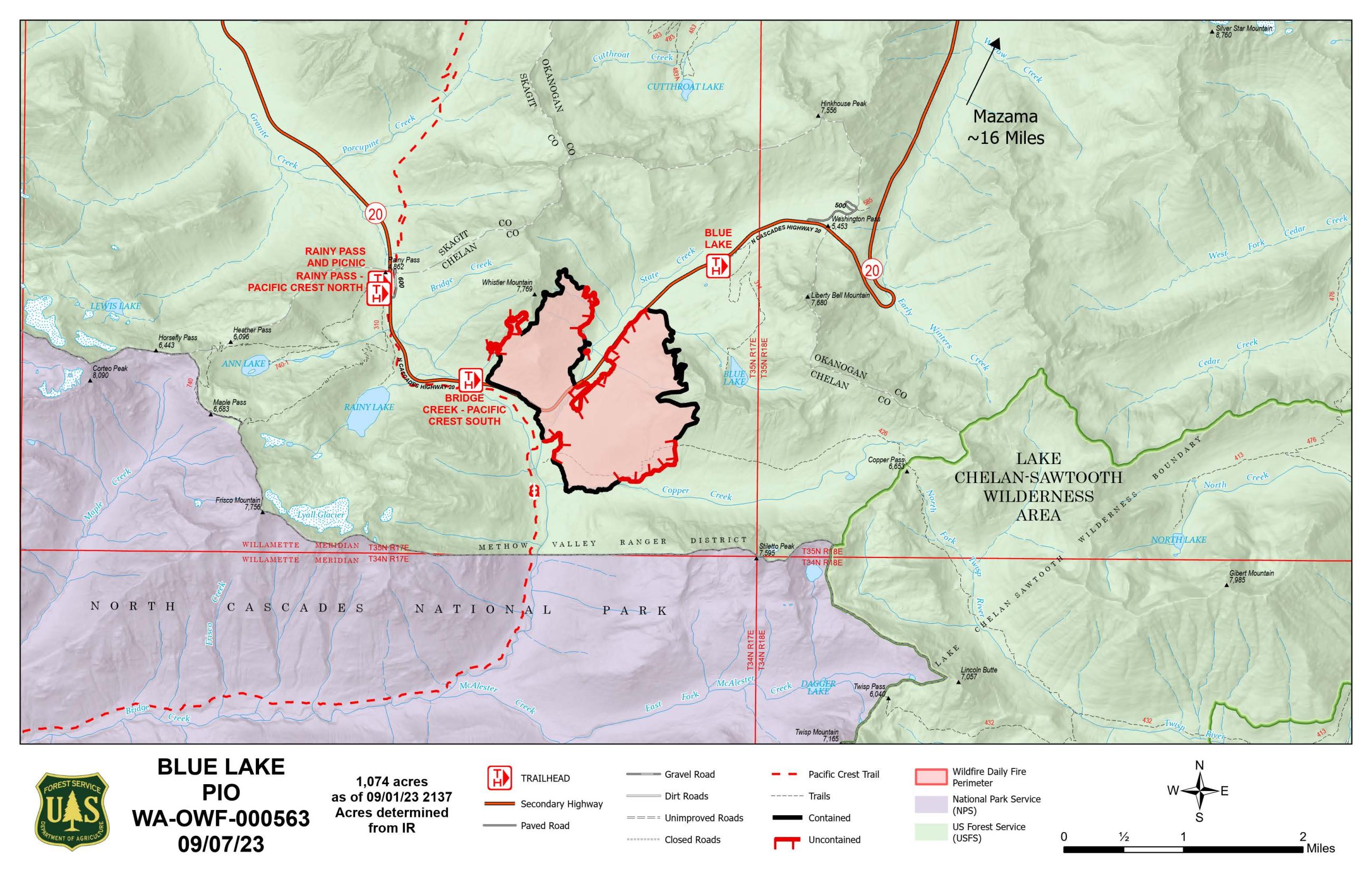
The North Cascades Highway (SR 20) is open with recommendation for reduced speeds through the fire impacted zone. The fire closure area was reduced on September 22, 2023.
Forest Service trailheads for #2000 Pacific Crest Trail, Blue Lake Trail, and Heather Maple Loop and Bridge Creek Trailhead are now open.
The following closures remain in effect:
- Trail No. 426 Copper Pass from Copper Pass west to the junction with Trail No. 2172 Stiletto Spur
- Trail No. 2171 Stiletto Spur
District firefighting resources continue to monitor the fire and closure areas. Please follow any fire crew directions in these areas and respect closed gates, fire equipment, etc.
For more information, check WSDOT at https://wsdot.com/travel/real-time/mountainpasses/north-cascade-hwy.
The Pacific Crest Trail has reopened in this area. However, we recommend you check PCTA webpage for closure information for other sections of the trail https://www.pcta.org/discover-the-trail/closures/washington/.
Closures remain in effect for areas of North Cascades National Park due to the Sourdough Fire. See https://www.nps.gov/noca/planyourvisit/fire-closures.htm for more information.
The Blue Lake Fire is currently 1074 acres and 80% contained.
| Current as of | Tue, 09/26/2023 - 15:50 |
|---|---|
| Incident Type | Wildfire |
| Cause | undetermined |
| Date of Origin | |
| Location | 13 miles southwest of Mazama, WA and 24 miles west of Winthrop, WA |
| Incident Commander | Tim Delph |
| Coordinates |
48° 29' 57.7'' Latitude
-120° 41' 34.7
'' Longitude
|
| Total Personnel: | 28 |
|---|---|
| Size | 1,074 Acres |
| Percent of Perimeter Contained | 80% |
| Estimated Containment Date | October 1, 2023 |
| Fuels Involved | Timber and brush |
| Significant Events | Fire behavior is minimal, and the fire area has recieved significant rain. |
| Planned Actions |
Crews continue to patrol, fell snags and backhaul equipment as needed. Some fire activity may continue to be visible, such as creeping and smoking in steeper, rocky and inaccessible areas. A BAER team has visited the fire and is preparing a final report that will be released when complete.
|
|---|---|
| Projected Incident Activity |
Indirect control lines are complete. Direct handline along the Pacific Crest Trail has been completed and mop up is nearly complete along these lines. Control lines are in place north of Highway 20 and crews continue to monitor and patrol the fire in this area. |
| Weather Concerns | A significant weather pattern change will develop Tuesday Sept 19 and continue into Wednesday as a pair of upper level disturbances track through the region. This will lead to much cooler temperatures and a very good chance of precipitation, especially on Wednesday. The cooler temperatures will also lead to some patchy frost early Wednesday and Thursday mornings. Drier and warmer weather is expected for most locations through the end of the workweek. Unsettled conditions look possible for the weekend. |
|---|