
Single Publication
Settings - change map background and toggle additional layers
Filter - control incident types displayed on map.
Zoom to your location
Reset map zoom and position
Could not determine your location.
Show Legend
 Wildfire
 Prescribed Fire
 Burned Area
Response
Burned Area
Response Other
Other
Reduced Closure Area for Post Wildfire Suppression Repair
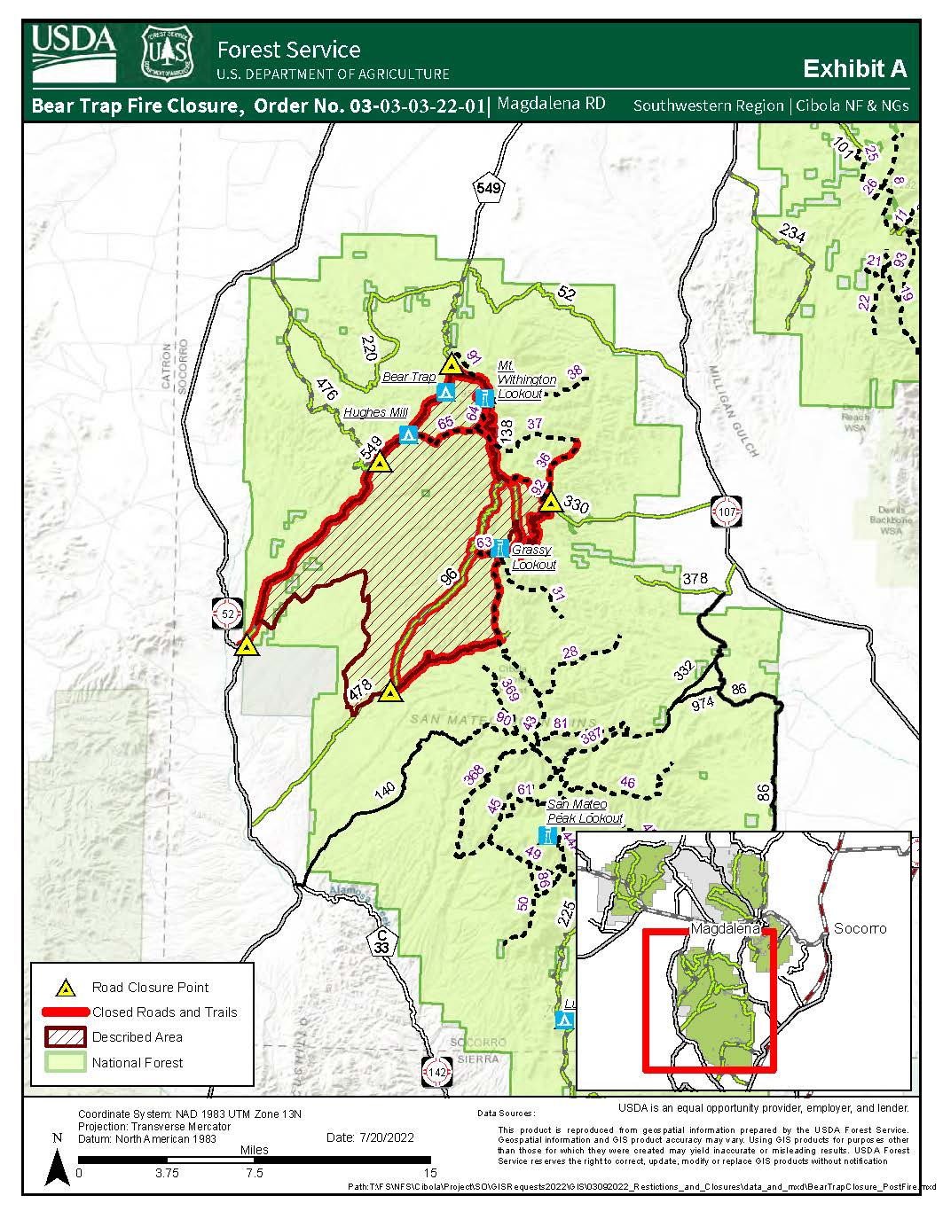
Bear Trap Fire
Publication Type: News 08/02/2022
Reduced Closure Area for Post Wildfire Suppression Repair
Bear Trap Fire - Magdalena Ranger District - San Mateo Mountains
Order Number 03-03-03-22-01
For more information on this order contact:
Magdalena Ranger District Office: 575-854-2281
The official order 03-03-03-22-01 posted on the Cibola NF & NGs website under Alerts & Notices.
# # #
USDA is an equal opportunity provider, employer, and lender.