
Update (10/12) 12 p.m.: Due to current snowy conditions, we've had to put a pause on our Blue Ridge prescribed burning operations for the rest of the year. A total of 331 acres were accomplished.
The recent snow has become an ally in our prescribed burning efforts, particularly in the mop-up phase. Mop-up work is a vital part of our mission, and it's generally a risky endeavor without moisture. It involves securing the fire's perimeter and extinguishing any remaining hotspots. But the snowy conditions from last night and today have transformed this task, making it safer and more efficient. The snow is like a natural fire extinguisher that our dedicated crews can rely on!
We are grateful for all the support from our community and partners during this process. Stay warm, and let's celebrate the power of nature in aiding our efforts!
An area closure is in effect between Big Meadows and Beaver Creek roads. Several local cooperating agencies will be involved. Smoke could be visible from various locations around Grand County.
_____________________________________________
The Blue Ridge Salvage and Fuels Reduction Project is part of the Forest Service’s on-going effort to improve forest health conditions on the Sulphur Ranger District. Blue Ridge is the geographic feature that runs North-South from Granby to Fraser, between the East Troublesome, Church Park and Williams Fork fires. Improving forest health conditions in this area is a key component of the Hot Sulphur, Fraser and Grand County Community Wildfire Protection Plans.
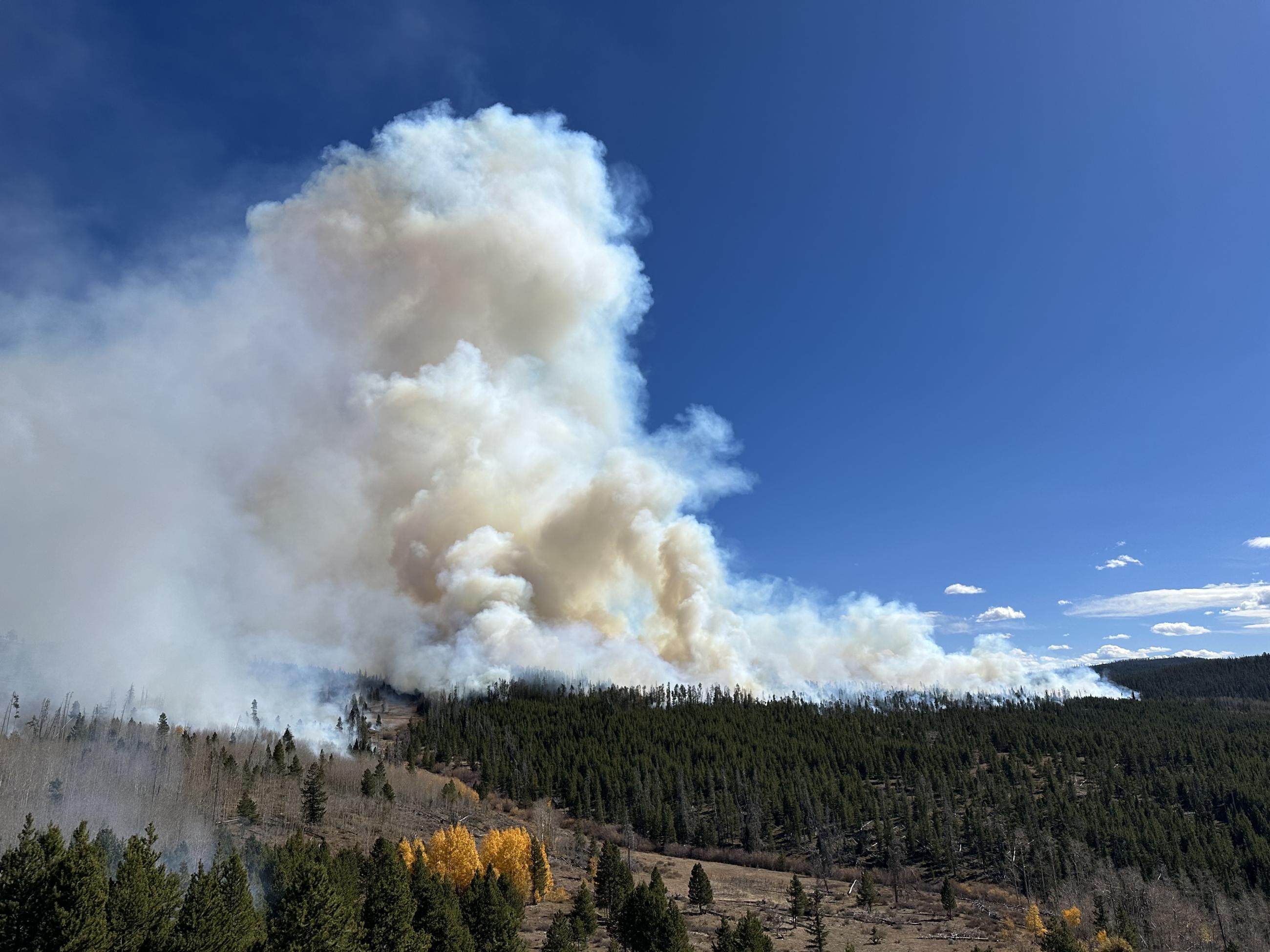
In past seasons, Arapaho National Forest firefighters with the help of many local cooperating agencies have successfully burned approximately 500 acres in the Blue Ridge area. This fall, fire managers are preparing to burn up to 1200 acres over multiple days, starting in Big Meadows south of Cottonwood Pass. Several local cooperating agencies will be involved. If conditions allow, burning could begin as soon as October 9, 2023.
Smoke from these activities could be visible from many areas in the county, including Parshall, Granby and parts of the Fraser Valley. Firefighters work closely with experts to minimize the impacts of smoke, and air quality is carefully monitored before and during a prescribed fire. All prescribed burns comply with state air quality regulations to minimize impacts. To learn more about the potential health impacts of smoke visit the Colorado Department of Public Health and Environment.
Prescribed fire is only implemented under very specific environmental conditions (e.g., wind speed, relative humidity, smoke dispersion). Prescribed fires are conducted by trained fire managers with a strong understanding of fire behavior and years of on-the-ground experience. These prescribed burns will only be implemented when pre-identified and contingency firefighting resources are available to support safe operations. Fire managers develop containment lines in advance by building fire line by hand, laying hose, and identifying existing fire breaks and natural barriers such as ridges, rivers, and roads. This helps keep the prescribed fire within its planned perimeter. Fire managers staff the fire until it is deemed secure and patrol the prescribed fire until it is declared out.
Even with the most thorough planning and preparation, the use of prescribed fire carries an innate level of risk that cannot be eliminated entirely. However, prescribed fire is one of the most efficient ways of reducing wildfire risk. Regularly conducting prescribed fires, which mimic nature, reduces the buildup of flammable vegetation and overgrowth.
This prescribed burn is part of the overall strategy on the Arapaho and Roosevelt National Forests to address the Wildfire Crisis. Prescribed fire is one of the most efficient ways of reducing wildfire risk. Regularly conducting prescribed fires reduces the buildup of flammable vegetation and overgrowth.
To receive updates, follow us on Facebook and Twitter, and join our email list through Constant Contact and select the list "Forest Health & Fire: Grand County (Winter Park, Fraser, Granby, Grand Lake, Hot Sulphur)."
| Current as of | Sun, 11/05/2023 - 14:00 |
|---|---|
| Incident Type | Prescribed Fire |
| Coordinates |
40° 01' 56.7'' Latitude
--106° 02' 12.5
'' Longitude
|