
Single Publication
Could not determine your location.
 Wildfire
 Prescribed Fire
 Burned Area
Response
Burned Area
Response Other
Other
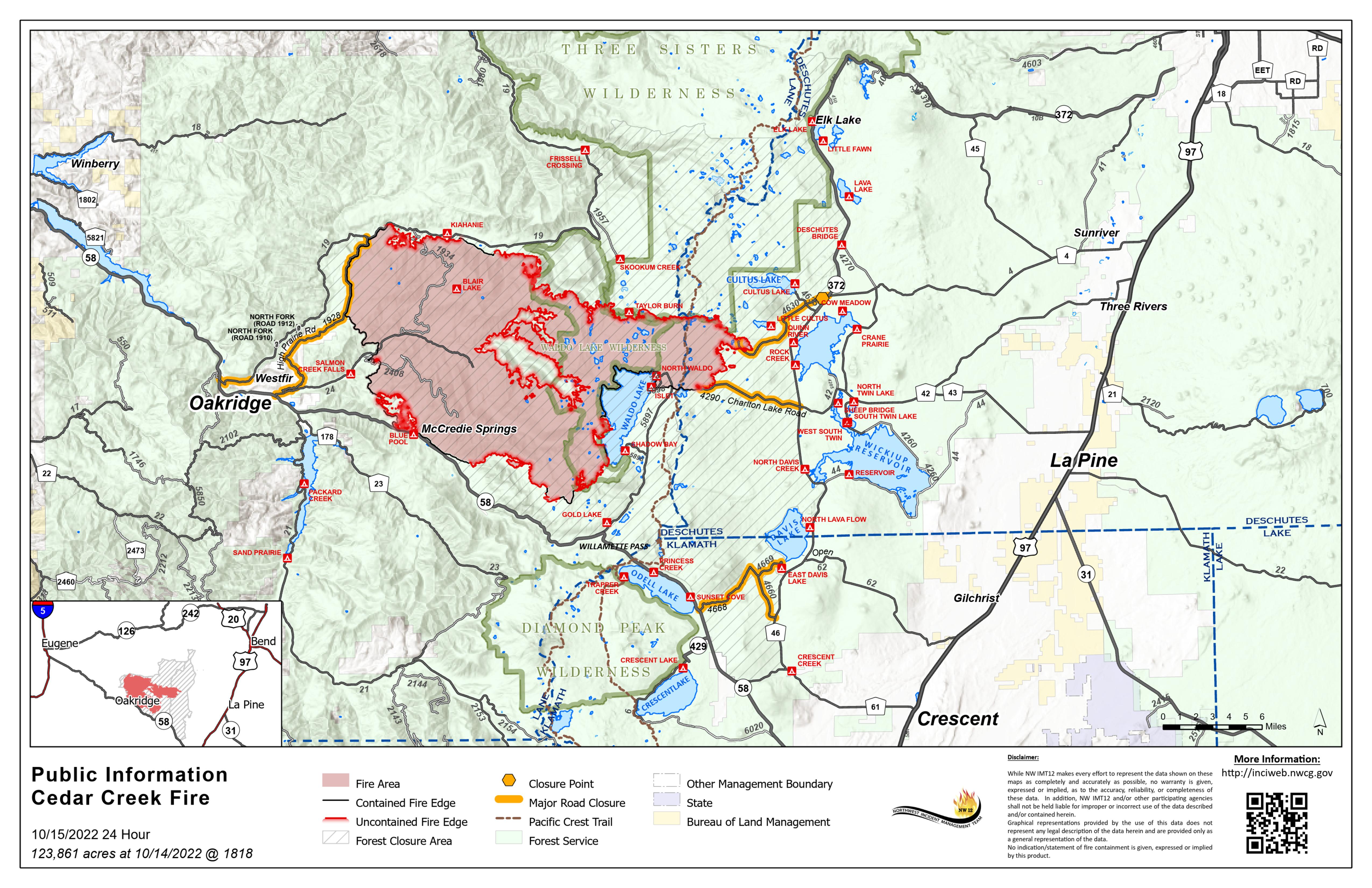
Cedar Creek Fire Update October 15, 2022
Cedar Creek Fire
Publication Type: News 10/16/2022
October 15, 2022 | Size: 123,861 acres | Origin: 15 miles E of Oakridge, OR | Containment: 40% | Cause: Lightning | Total personnel: 669 | Resources: 20 engines;13 crews; 7 helicopters; 7 heavy equipment | Start Date: August 1, 2022
A community meeting will be held on Sunday, October 16 at 4pm at the Oakridge High School Auditorium.
Weather: A red flag warning is in effect from 2am Saturday, October 15th until 6am Sunday, October 16th. The red flag warning combined with dry and receptive fuels present firefighters with critical fire danger. The morning inversion will still be quite strong. Temperatures are expected to be a few degrees cooler, but still 70-80 degrees. Minimum relative humidity will be 15-20 percent. Winds are expected to remain southeast throughout the day with gusts on the ridges 15-30 mph both day and night.
Operations: In anticipation of critical fire danger, firefighters will continue to monitor and patrol the fire area near containment lines, focusing efforts in areas that have previously challenged containment lines. Resources will be engaged on the southern tip of the fire to continue holding and securing the areas where fire crossed the line last week. Assessment and repair continue on Forest Service Road 1944 along the northern edge of the fire. Chipping operations to remove debris and road repairs are ongoing on the western fire perimeter. Chipping operations and road grading will also be underway near Cultus Lake and on Forest Service Road 4868.
Suppression repairs on the Big Swamp and Potter Fires should be completed by the end of shift tomorrow.
Closures: There are closures in effect on the Deschutes National Forest and Willamette National Forest. These closures will remain in place until areas impacted by the fire are surveyed for safety risks and fire crews are able to mitigate these hazards. Please respect Forest closures for firefighter and public safety. Please visit Willamette National Forest and Deschutes National Forest for the most recent closure orders and maps. Pacific Crest Trail hikers should visit pcta.org for current information. There is a Temporary Flight Restriction over the Cedar Creek Fire area. Wildfires are a No Drone Zone - if you fly, we can’t.
Smoke: Air quality conditions due to smoke are expected to be Good to Hazardous within the forecast area. Smoke impacts will be heavily dependent on fire activity. For current conditions, see Fire.airnow.gov, oakridgeair.org, and LRAPA - Today's Current Air Quality. Smoke Forecast Outlooks are available at https://outlooks.wildlandfiresmoke.net/outlook.
Evacuations: A map of the evacuation area is available at www.LaneCountyOR.gov/CedarCreek. Sign-up for emergency mobile alerts by going to oralert.gov. Please check with Lane County Sheriff’s Office at 541-682-4150 and Deschutes County Sheriff’s Office at 541-693-6911 for updates and changes.
Online: https://inciweb.nwcg.gov/incident/8307/ | www.facebook.com/CedarCreekFire2022/ www.tinyurl.com/cedarcreekfireyoutube| Fire Information Line: 541-201-2335, 8:00 AM – 8:00 PM | For Media Inquiries: 541-327-9925 | Email: 2022.cedarcreek@firenet.gov