
Single Publication
Could not determine your location.
 Wildfire
 Prescribed Fire
 Burned Area
Response
Burned Area
Response Other
Other
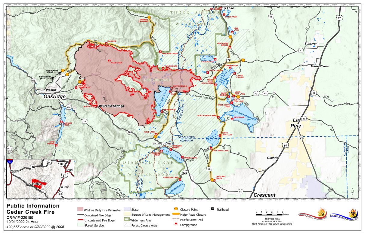
Cedar Creek Fire Update October 1, 2022
Cedar Creek Fire
Publication Type: News 10/01/2022
Cedar Creek Fire
October 1, 2022 | Update 8:30 AM | Size: 120,655 acres | Contained: 27% | Start Date: August 1,2022 | Origin: 15 miles east of Oakridge, OR
Cause: Lightning | Total personnel: 1,022 | Resources: 28 engines; 18 crews; 19 heavy equipment; 8 helicopters
A shift in wind direction has been contributing to an increase in fire activity and gusts out of the east have pushed smoke from across the fire toward the community of Oakridge and surrounding areas. This east wind is expected to continue and increase over the weekend. Unlike the east wind event several weeks ago that generated extreme fire behavior, this eastly wind is accompanied by cooler temperatures, higher relative humidity, and, thanks to firefighter efforts, a reduced fuel load.
West Zone Operations: Yesterday, crews and heavy equipment continued work to repair areas that have been disturbed by firefighting activities along the northern edge of the fire. A task force of firefighting resources will be engaged along the southwest edge of the fire where there is uncontained fire line that could be tested by wind conditions and rising temperatures. Poor air quality in the Highway 58 corridor, Oakridge and adjacent communities is expected to persist throughout the weekend. Temperature inversions will trap smoke in the valleys and drainages during the morning hours and into the afternoon. For air quality resources, see the links below.
Weather: Increased temperatures and gusting winds out of the east are predicted throughout the weekend. As the warming and drying trend continues, relative humidities will continue to drop. Sunday will remain warm and dry, but winds will begin to diminish and shift to westerly.
Smoke: For current conditions, see Fire.airnow.gov, oakridgeair.org, and LRAPA - Today's Current Air Quality. Smoke Forecast Outlooks are available at https://outlooks.wildlandfiresmoke.net/outlook.
Evacuations: An updated map of the evacuation areas is available at www.LaneCountyOR.gov/CedarCreek. Sign-up for emergency mobile alerts by going to oralert.gov. Please check with Lane County Sheriff’s Office at 541-682-4150 and Deschutes County Sheriff’s Office at 541-693-6911 for updates and changes.