
Single Publication
Could not determine your location.
 Wildfire
 Prescribed Fire
 Burned Area
Response
Burned Area
Response Other
Other
USGS Post-Fire Debris-Flow Hazard Assessment Map for Nogal Canyon Fire
Nogal Canyon Post-Fire BAER
Publication Type: News 04/26/2022
USGS Post-Fire Debris-Flow Hazard Assessment Map Completed for Nogal Canyon Fire
The Nogal Canyon Post-Fire Burned Area Emergency Response (BAER) assessment team coordinated with the US Geological Survey (USGS) during its evaluation of the burned area to assess potential post-fire hazards, including debris flows.
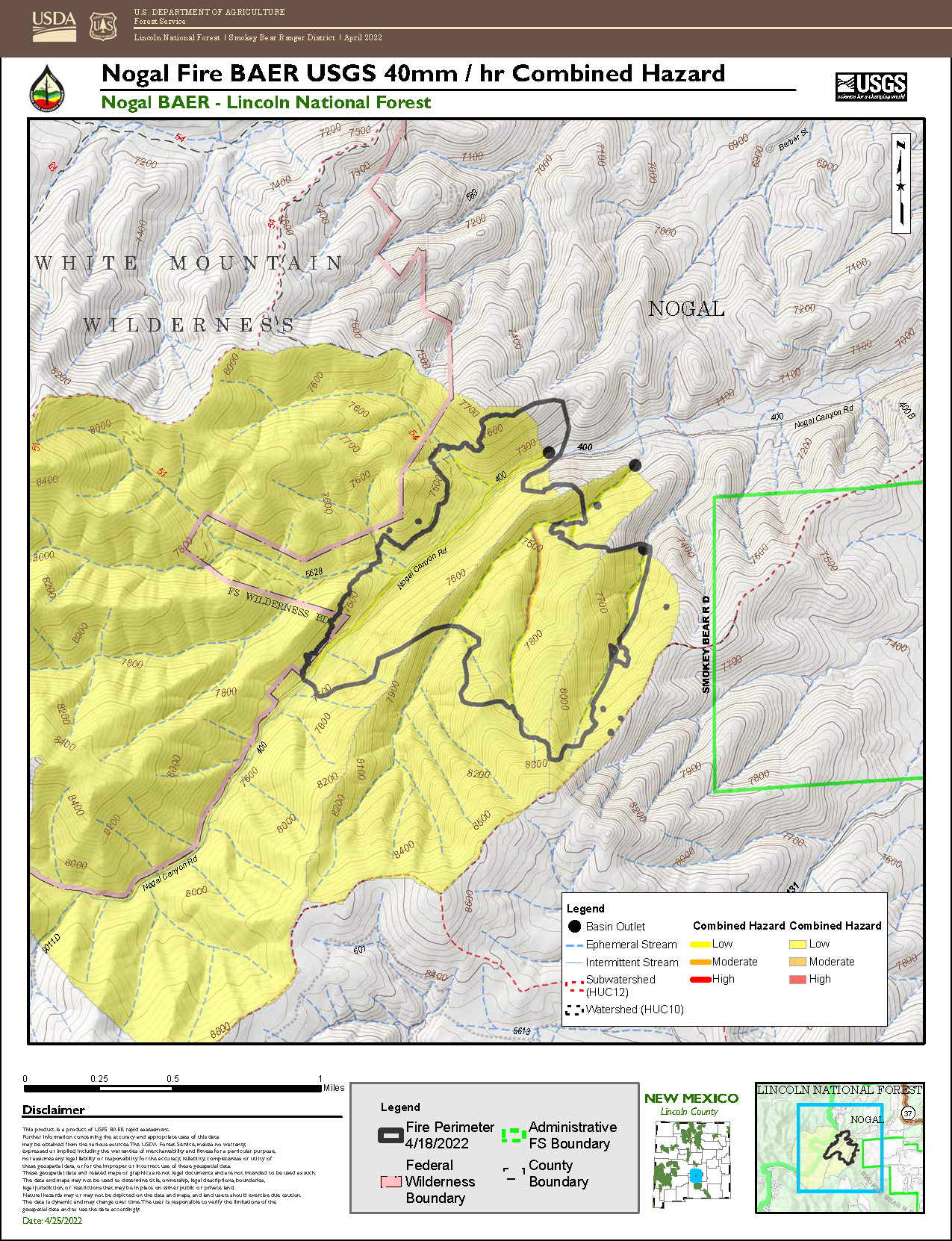
USGS utilized the BAER team’s soil burn severity (SBS) map to model potential debris flow hazards within the burned area. The data estimates debris-flow likelihood, volume, combined hazard, and rainfall thresholds and are presented in the debris flow map (see below). The combined relative hazard metric is a combination of the likelihood of debris flow (in %) and potential volume of debris flow (in m3).
The map depicts the likelihood of debris-flow generation and estimates of flow magnitude in locations where debris flows initiate. The models do not predict downstream impacts, potential debris-flow runout paths, or the spatial extent of debris-flow or flood inundation.
This information is extremely important to inform our safety awareness of the burned areas, especially where there may be an increased risk of hillslope erosion, flooding sediment delivery to streams, and a higher probability of debris flows – all of which are potential risks to human life, safety, and property.
For information on what to do if you live in a recently-burned area where debris flows are possible, and there is a rainstorm - before, during, and after, download the National Weather Service Post Wildfire Flash Flood and Debris Flow Guide (PDF 7.2 MB).
For additional information about the USGS emergency assessment of post-fire debris-flow hazards, go to: Emergency Assessment of Post-Fire Debris-Flow Hazards (usgs.gov).
Additional scientific information about the USGS debris-flow hazard report and analysis for the Nogal Canyon Fire:
USGS models estimate a low-level debris-flow hazard for most of the area burned by the Nogal Canyon Fire. All of the stream reaches and small drainage basins have a less than 20% likelihood of debris-flow occurrence at the modeled rainfall intensity. All of the burn area requires rainfall rates between greater than 40 mm/h to exceed a 50% likelihood of debris-flow occurrence. The two larger modeled watersheds are estimated to produce volumes between 10,000-100,000 m3. One smaller watershed in the eastern portion of the burn area is estimated to produce 3. The combined debris-flow hazard is low for the entire burn area. The year 1 and 2 model-estimated rainfall thresholds (segment-scale) and corresponding return intervals are as follows:
YEAR 1:
15-minute: 68 mm/h, or 0.7 inches in 15 minutes, RI = 1.4 years
30-minute: 48 mm/h, or 0.95 inches in 30 minutes, RI = 1.6 years
60-minute: 48 mm/h, or 1.9 inches in 60 minutes, RI = 8.2 years
YEAR 2:
15-minute: 89 mm/h, or 0.9 inches in 15 minutes, RI = 3.2 years
30-minute: 62 mm/h, or 1.25 inches in 30 minutes, RI = 3.7 years
60-minute: 64 mm/h, or 2.55 inches in 60 minutes, RI = 32.2 years
BAER SAFETY MESSAGE: Everyone near and downstream from the burned areas should remain alert and stay updated on weather conditions that may result in heavy rains and increased water runoff. Flash flooding may occur quickly during heavy rain events be prepared to act. Current weather and emergency notifications can be found at the National Weather Service website: www.weather.gov/abq/.
