U.S. flag

An official website of the United States government

Here's how you know

Incident Media Maps

Zoom to your location
Reset map zoom and position

Could not determine your location.

Mt. Baker-Snoqualmie Post-Fire BAER

Share this incident

Unit Information

Washington 
Everett, 
98201 
Washington 
Everett, 
98201 

Incident Contacts

  • Mt. Baker-Snoqualmie National Forest
    Email:
    colton.whitworth@usda.gov
    Phone:
    425-783-6050

Maps Gallery

[ PDF ]

Updated Soil Burn Severity Map for Suiattle Fire October 29, 2022

[ PDF ]

Soil Burn Severity Map for Loch Katrine October 29, 2022

[ PDF ]

Updated Soil Burn Severity Map for Bolt Creek October 29, 2022

Image options: [ Full Size ] -

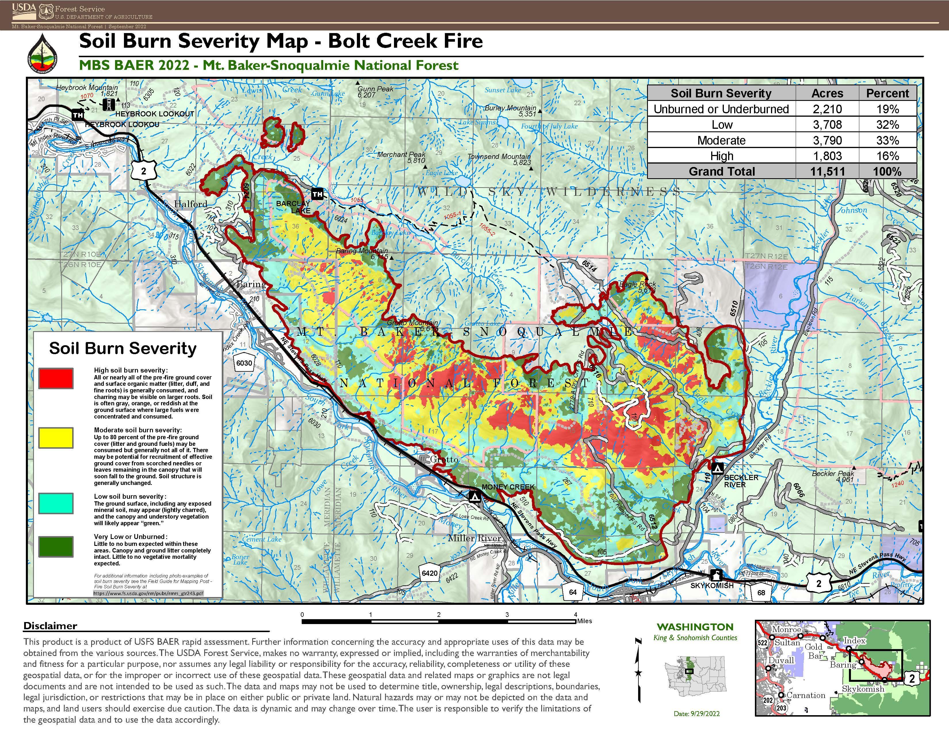
This map shows soil burn severity levels across different areas of the Bolt Creek Fire perimeter

Image options: [ Full Size ] -

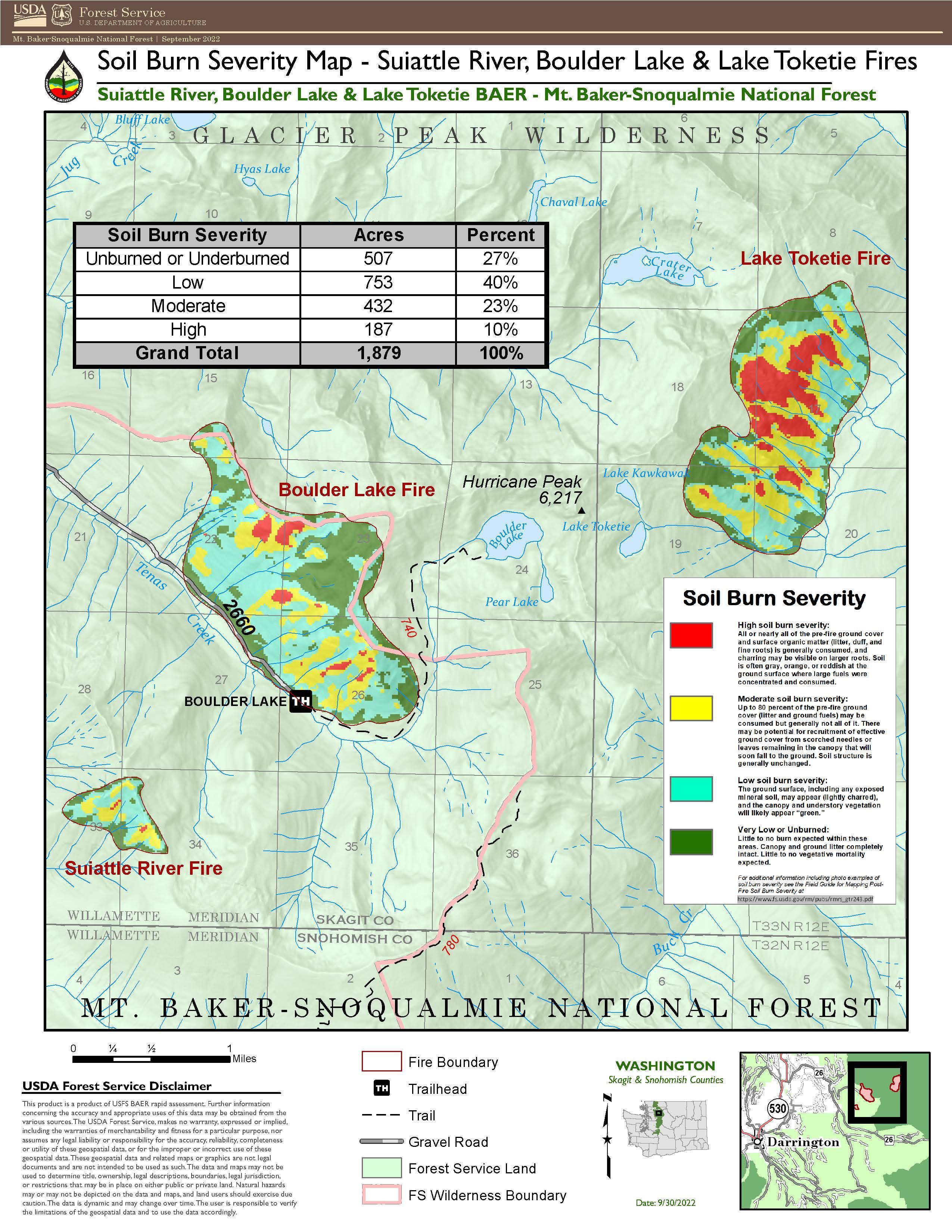
This map shows soil burn severity levels across different areas of the Suiattle River, Boulder Lake and Lake Toketie Fire perimeters